Summary
Emerging evidence suggests the Amazon rainforest's ability to absorb carbon is weakening, potentially becoming a source of emissions. Despite this, significant uncertainty remains regarding about the region’s current and projected greenhouse gas (GHG) emissions. To address this gap, the Carbon Amazon Rainforest Activity project is collecting new and detailed observations to improve understanding of GHG emissions trends from natural sources in the Amazon through combined ground, airborne, and satellite observation campaigns across a 100 × 100 km area of the eastern Amazon, Pará State, Brazil.
This study is led by King’s College London and is a collaboration between ESA, research institutions from ESA Member States and Brazil’s National Institute for Space Research (INPE) and Federal University of Western Pará (UFOPA).
Rationale
In its Strategy to Support the Global Stocktake of the UNFCCC Paris Agreement, the Committee on Earth Observing Satellites (CEOS) identifies the Amazon as a potential tipping point of terrestrial carbon emissions in the near future. Despite this, significant uncertainty remains regarding about the region’s current and projected greenhouse gas (GHG) emissions. To address these gaps, CEOS has called for a large-scale field experiment to provide new and detailed observations that improve scientific understanding of emission trends from natural sources in the Amazon Basin. Specifically, to better understand the carbon dynamics in carbon stocks and fluxes (CO2, CH4, N2O) associated with different land cover types and fire.
This project responds directly to this call. It is a collaborative field study involving research institutions from across Europe and Brazil and has been designed to generate new and detailed observations to support assessment of GHG emissions in the Amazon. By integrating ground-based (proximal and in-situ), airborne (remote sensing and in-situ), and satellite observations, the project aims to improve understanding of natural emissions processes and their responses to ongoing environmental change.
Science objectives & experimental set up
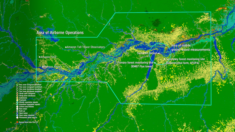
The project comprises a campaign of concurrent airborne sorties and satellite overpasses over an instrumented over the eastern Amazonian study area, around the city of Santarém, Para State.
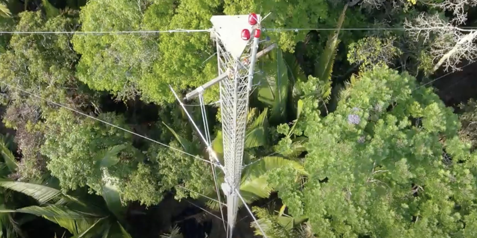
Ground-based sensors in fixed locations have been deployed in primary and secondary forest, while mobile or ‘roving’ measurements will be used to complement assessment of fire impact around Santarém.
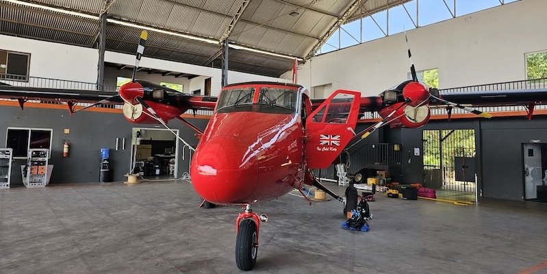
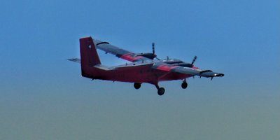
The airborne campaign will study and characterise the region's land area from above using a variety of advanced remote sensing methods, whilst simultaneously sampling the atmosphere to measure the land-atmosphere transfers of greenhouse gases, particulates and various air pollutants, both in and out of primary and degraded forest and also from the regions fires. Airborne activities have been made possible through close cooperation between ESA, participating European research teams, Brazil’s National Institute for Space Research (INPE) and Federal University of Western Pará (UFOPA) – one of the few times such research has been allowed in recent decades.
Science goals
The campaign's science goals aim to improve GHG quantification and Verification, improve fire impact assessment, and support both satellite validation and model development and is focussed across three process-related Science Themes
(I) Landscape Scale (non-Fire) GHG Fluxes
(II) Vegetation Processes and Carbon Storage, and
Study area
The study area focusses on a 100x100 km area in the western region of Para State, Brazil with locations positioned in and around the city of Santarém (2.441° S, 54.714°E) which includes the full range of land cover types from intact and secondary forest, agriculture and degraded land. The area is primarily of scientific interest as it falls within an area of the Amazon forest which is thought to already exhibit dry-season increases in Gross Ecosystem Productivity and transitioning from a carbon sink to a net emitter or source of carbon. The study area has a number of advantages, making it suitable for an integrated ground-observations campaign:
- Widespread coverage of primary and secondary or degraded forest and other land cover types
- Pre-existing research infrastructure, as part of the Large-Scale Biosphere-Atmosphere Experiment in Amazonia (LBA) led by INPE and experimental farm activities of UFOPA, that can be utilised
- Frequent fire activity is anticipated to coincide with the proposed campaign timing, based on satellite records
- Santarém airport is suitable for hosting the BAS Twin Otter research aircraft, enabling observations from the airborne campaign to be integrated into the study.