
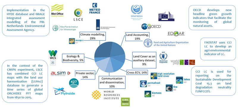
Initially targeted to key climate modelling communities, the CCI LC maps series has been widely used among a far more diverse community in a variety of applications less directly related to the climate.
Since the release of the CCI LC Climate Data Record (CDR), this unique long-term LC time series has met many unexpected needs. LC and land cover change (LCC) maps can be useful in many domains, with varied applications such as climate change, land accounting, forest monitoring, desertification and agriculture. As such, several significant collaborations have taken place with various projects, programs, national agencies and international bodies.
The climate modelling and academic communities remain the major users of the CCI LC map series but the political arena and private sector are also eager to monitor the land cover in various contexts such as deriving statistics, indicators related to land accounting and global biodiversity targets.
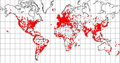
As of September 2020, we count 60,400 downloads of the CCI LC products from 18,337 IP addresses, corresponding to a volume of 55TB.
Extending the CCI LC map series to 2016-2019 in an operational manner within the Copernicus Climate Change Service
The Copernicus Climate Change Service (C3S) provides global annual LC maps from 2016 to 2020. The CCI LC team is pleased to announce that the 2016, 2017, 2019 LC maps have already been generated. The 2016-2018 series are available publicly on the C3S CDS and the 2019 LC maps will be released and validated by end of 2019.
In 2017, the CCI LC team officially released the first time series of annual global LC maps at 300m, spanning 24 years, from 1992 to 2015; thus contributing to the objective of providing the longest possible, consistent and mature climate data records at the global scale. This unique dataset has been endorsed by Copernicus as a part of Copernicus Climate Data Records.
Exploiting the expertise gained during the CCI LC project and the recognised maturity of the CCI LC products, the R&D carried out by the CCI LC team is now operationally and routinely applied within the Copernicus Climate Change Service (C3S) to deliver the LC maps series extension from 2016 to 2020 in a fully consistent manner.
The annual LC maps 2016-2018 were produced using Proba-V imagery, and their quality assessed. Their overall accuracies are of 71.1% (n=1350).
The validation procedure used an independent reference database, inherited from the CCI LC project. This validation database was built, independently, by interpretation of very high resolution (VHR) imagery thanks to an international network of LC experts and was continuously updated within C3S to reflect current years