
Data
The following data is available from the RECCAP-2 project.
The Global Carbon Atlas allows for quick time-series and map visualisation of the carbon fluxes from the datasets used in RECCAP-2.
The Global Carbon Atlas is an online platform to explore, visualize and interpret global and regional carbon data arising from both human activities and natural processes. The graphics and data sources are made available in the belief that their wide dissemination will lead to new knowledge and better-informed decisions to limit and cope with human-induced climate change. The Global Carbon Atlas is a community effort under the umbrella of the Global Carbon Project based on the contributions of many research institutions and individual scientists around the world who make available observations, models, and interpretation skills.
The land-surface CO2 fluxes from the five inversions and 14 dynamic global vegetation models from GCB2018 (Le Quéré et al. 2018) can now be explored in the Global Carbon Atlas:
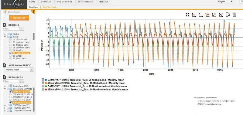
For data access, please contact:
- Inversions: see product tooltip or peylin@lsce.ipsl.fr
- TRENDY: s.a.sitch@exeter.ac.uk