Terrestrial vegetation plays a major role in the climate system through primary productivity by photosynthesis and respiration, recycling of precipitation, and soil formation. Two essential climate variables (ECVs) that describe the state of the vegetation are the Leaf Area Index (LAI) and fraction of incident surface solar radiation in the photosynthetically active region (0.4-0.7 μm) absorbed by vegetation (FAPAR). Consistent, global time series of LAI and FAPAR can provide insight into the dynamic role of vegetation in the Earth's climate.
The Leaf Area Index (LAI) of a plant canopy or ecosystem, defined as one half of the total leaf area per unit horizontal ground surface area, determines the size of the interface for exchange of energy (including radiation) and mass between the canopy and the atmosphere. It also partly controls photosynthesis and respiration. Monitoring its distribution and changes is important for assessing growth and vigour of vegetation on the planet.
FAPAR plays a critical role in assessing the primary productivity of canopies, the associated fixation of atmospheric carbon dioxide, and the energy balance of the surface. It is one of the main inputs of Light Use-Efficiency (LUE) models to estimate biomass production.
Objective
The objective of the project is to develop a dataset and a processing chain for global, multi-decadal time series of LAI and FAPAR that is both ready for operational use, and that has demonstrated added value for the climate science community.
In the project we aim for the following innovations:
Maximizing the use of EO data: The final data sets will cover the global land mass for the period 2000-2021 at 1 km and 300m and will be based on the optimal joint retrieval of the following sensors:
- SPOT4/VGT1 and SPOT5/VGT2
- Terra/MODIS and Aqua/MODIS
- ENVISAT/MERIS
- Metop-A/B/C-AVHRR
- PROBA-V
- Sentinel-3/OLCI
- VIIRS
Using an innovative retrieval algorithm: A computationally efficient radiative transfer model inversion will make synergistic use of multiple satellite missions possible. After atmospheric correction, a coupled model for soil, snow, vegetation model and residual atmospheric effects will be used. The algorithm enables the optimal use of available data in a time window, and the quantification of uncertainties of the product.
Maximising the use of validation data: The selected sites include the following locations for which ground data is available or which are representative of global conditions (see also Figure 4):
- Direct 2.1: 140 sites with ground data for specific campaigns, 2000-2021
- GBOV: 23 sites with multi-temporal ground data, 2013-2019
- AMMA: 13 sites with multi-temporal ground data, 2005-2015
- LANDVAL v1.1: 720 sites for product inter-comparison
- Sites defined by the Climate Research Group
Exploiting synergies with other ECVs: In two science studies the fitness of the data products will be evaluated for the modelling of light and water use efficiency, combined with other ECVs, and for the identification of the effects of temperature anomalies in time series. A feasibility study for the solar induced chlorophyll fluorescence (SIF) will investigate the possibilities of SIF as a complementary ECV.
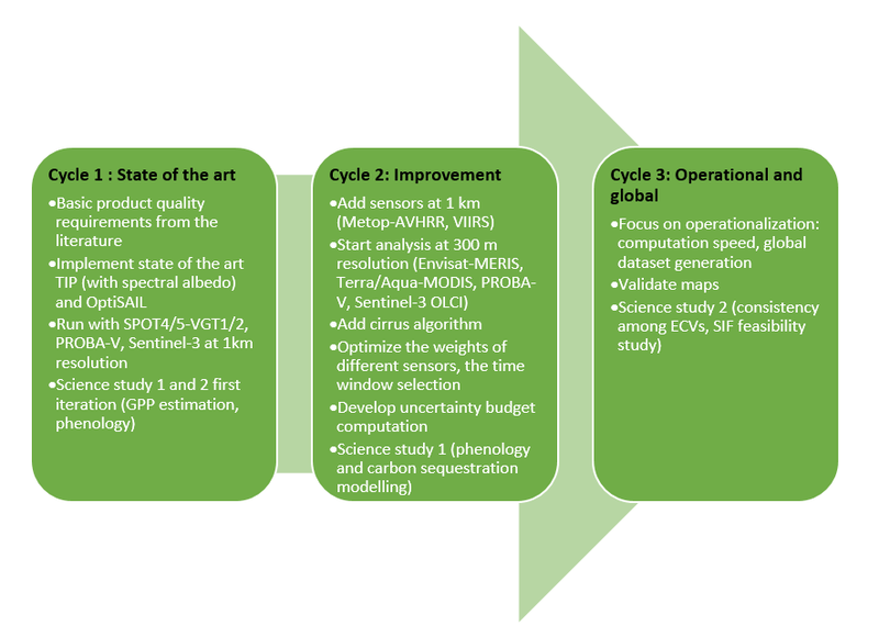
The project is organised in 3 cycles, focusing the development of the algorithm using state of the art tools, improvements by the progressive inclusion of more sensor data, and stepping up towards operational use. Science studies with the data will run in parallel to assess the scientific value of the products.