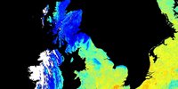
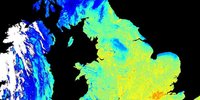
Land Surface Temperature (LST) is an important variable within the Earth climate system. It describes processes such as the exchange of energy and water between the land surface and atmosphere, and influences the rate and timing of plant growth.
Accurately understanding LST at the global and regional level helps to evaluate land surface–atmosphere exchange processes in models and, when combined with other physical properties such as vegetation and soil moisture, provides a valuable metric of surface state.
LST also provides independent temperature data to complement in situ measurements and reanalysis associated with near-surface air temperature – a fundamental target outlined in the UNFCCC Paris agreement.
The LST_cci project aims to provide an accurate view of temperatures across land surfaces globally over the past 20 to 25 years and meet the requirements of Global Climate Observing System (GCOS) for climate applications by developing techniques to merge archived data from a variety of satellites into a combined long-term satellite record for climate.
Objective
- The ultimate objective of the LST_cci project is to provide the following results:
- An expected accuracy and precision of all the LST ECV Products of < 1 K
- A first assessment of the stability of LST ECV Products
- A first global LST CDR with record length over 25 years
- A first passive microwave time series with record length of over 20 years
- Intercalibration and time difference corrections of level-1 data for CDRs
- Retrieval algorithm consistency across LST ECV products and CDRs
- Consistency of uncertainty approach
- Optimisation of the best cloud clearing detection across new sensors
- Demonstration of seamless end-to-end LST ECV production for complete multi-mission archives
- Fully independent and rigorous product validation and intercomparison extended to new sites and external data sets
- Publications in world-leading journals demonstrating climate application exploitation of LST ECV Products
- Significantly increase the maturity levels of all LST ECV products
About the project
The project will more specifically provide the following results:
- A strong validation component providing globally representative and consistent in-situ validation and intercomparison of LST products over all the major land cover types, informing the climate community of the performance of the LST ECV products
- Sustained support to the surface temperature community through dedicated effort into the well-established International LST and Emissivity Working Group (ILSTE) which is the principle forum of community expertise from data providers to users
- Detailed climate user input into the specifications of the LST ECV products, and user assessment of these products to drive LST exploitation in climate science
- Strong buy-in from the climate science community coordinated by the Climate Research Group, with key inputs from the CMUG and CSWG, and user interaction at two dedicated user workshops
- A comprehensive suite of high quality IR LST ECV Products and MW LST ECV Products for geostationary (GEO) and low earth orbit (LEO) satellites covering a range of time periods from 1995 for the earliest sensor through to 2020 for many current and some future sensors
- A first merged IR CDR from input bias corrected Level-1 GEO and LEO data at 0.05° and 3-hourly. This system specification will confront the expected requirements for an operational LST climate service.
- A consistent long-term LST CDR of 25 years from 1995 to 2020 for ATSR-2 through to SLSTR by bridging and filling the gap between AATSR and SLSTR
- Demonstration of a coherent and open pre-operational End-to-End processing system for delivering the LST ECV Products to the climate user community
- A strong validation component providing globally representative and consistent in-situ validation and intercomparison of LST products over all the major land cover types, informing the climate community of the performance of the LST ECV products with respect to the GCOS requirements
- Sustained support to the surface temperature community through dedicated effort into the well-established International LST and Emissivity Working Group (ILSTE) which is the principle forum of community expertise from data providers to users
Explore the land surface data (1996-2020) (Version: v2.23)
The latest global LST_cci products are provided via the CCI Open Data Portal:
- ATSR-2
- Satellite: ERS-2
- Period: 1995-2003
- Products: 1 km L2P, 0.01° daily + monthly L3C
- AATSR
- Satellite: ENVISAT
- Period: 2002-2012
- Products: 1 km L2P, 0.01° daily + monthly L3C
- MODIS
- Satellites: TERRA and AQUA
- Period: 2000-2018 (Terra), 2002-2018 (Aqua)
- Products: 1 km L2P, 0.01° daily + monthly L3C
- SLSTR
- Satellites: S3-A and S3-B
- Period: 2016-2020 (S3-A), 2018-2020 (S3-B)
- Products: 1 km L2P, 0.01° daily + monthly L3C
- Merged IR CDR
- Satellites: GEO+LEO IR
- Period: 2009-2020
- Products: 0.05° 3-hourly L3S
- ATSR-SLSTR CDR
- Satellites: ERS-2, Envisat, Terra, Sentinel-3
- Period: 1995-2020
- Products: 0.05° daily + monthly L3S
- SSM/I, SSMIS
- Satellites: DMSP F13, F17
- Period: 1996-2020
- Products: 0.25° daily + monthly L3S
A data issue tracker is made available via this link. Please note that this file contains information on the beta products, which are only available via Jasmin to selected users.
However, there is still some very useful information about products which are listed above and available from the Open Data Portal.
The following documents have been published by the Land Surface Temperature ECV project.
- User Requirements Document (version 3.0)
- System Requirements Document (version 1.1)
- Product Specifications Document (version 2.0)
- Data Access Requirement Document (version 2.0)
- Algorithm Theoretical Basis Document (version 4.0)
- System Verification Report (version 2.0)
- Product Validation Plan (version 2.0)
- Climate Assessment Report (version 3.0)
- Product User Guide (version 2.0)
- Product Validation and Intercomparison Report (version 3.2)
- Climate Research Data Package (version 2.1)
- End-to-End ECV Uncertainty Budget (version 3.0)
- Algorithm Development Plan (version 5.0)
- 2022 User Workshop Report
- ATBD of the LST_cci regridding tool (version 2.1)
- Project Science highlights - issue 4
This document was prepared during the DUE GlobTemperature project, about the nomenclature of LST products
The Land Surface Temperature consortium is based on a close collaboration between the following partners.
- University of Leicester (primary)
- ACRI-ST
- National Centre for Earth Observation (NCEO)
- University of Reading
- UK Met Office
- ESTELLUS
- University of Valencia
- Karlsruhe Institute of Technology
- Instituto Português do Mar e da Atmosfera (IPMA)
- RUHR-UNIVERSITÄT BOCHUM (RUB)
- Danish Meteorological Institute (DMI)
- Max Planck Institute for Bioeochemistry
- Luxembourg Institute of Science and Technology (LIST)
- Meteo Romania
User Workshop 3 | 5-6 December 2024
The last LST_cci workshop has been held as part of a joint satellite remote sensing event taking place at the Space Park in Leicester, UK, 2-6 December 2024:
- Thermal Remote Sensing Workshop (2-4 December) – this is primarily an educational and networking event. Please see the Thermal Remote Sensing Special Interest Group webpages for further information. Please register for the mailing list to receive further information about this group.
- LST_cci Workshop (5-6 December; note 6 December is morning only) – this workshop is about satellite Land Surface Temperature (LST) from both thermal infrared and microwave satellite instruments produced by the ESA LST_cci project and welcomes all current and potential users of any satellite LST data. Please see the LST_cci 2024 Workshop Webpage for further information. Please register for the LST_cci mailing list to receive further information about this project and the workshop.
Topics for the LST_cci 2024 Workshop included:
- An overview of the LST_cci project, and its products and outputs
- Examples of user case studies that have utilised LST_cci data
- User requirements for satellite LST
- User applications for satellite LST
Agenda, presentations and posters
User Workshop 2 | 27-29 September 2022
The LST_cci 2022 workshop held a virtual event, with both live sessions on Zoom and an ‘offline’ discussion forum, where session recordings and posters will are available.
The aim of this workshop was to provide:
- an opportunity for the LST_cci project team to update users on the progress and outputs of the project so far, and to gather new user requirements to guide the development of Phase II (2022-2025) products
- a demonstration of the new LST_cci tool to enable users to re-grid LST_cci products to a different spatial resolution
- a demonstration on how to use and understand uncertainty information in the LST_cci products
- a forum for users to present their work involving LST data
- an opportunity to discuss the use of LST products in climate services, and in particular within the Coupled Model Intercomparison Project (CMIP)
Agenda, presentations and posters
User Workshop 1 | 24-26 June 2020
The workshop was open to anyone who works with satellite LST data, or who has an interest in working with these data in the future. The workshop provided a forum for both users and providers of satellite LST data to share their experiences and knowledge in this field. The focus of the meeting was on LST data set development and applications.
In addition to providing a brief overview of the LST CCI project, the topics for this workshop includes (but is not limited to):
- Climate user applications for satellite LST
- Climate user requirements for satellite LST
- Development of climate LST data sets
- Uncertainties in satellite retrievals of LST
- Climate services and satellite LST
- The role of satellite LST observations in future IPCC Assessment Reports
Agenda
- View the meeting agenda
Presentations, posters and meeting documents
Re-gridding and sub-setting tool
The re-gridding and sub-setting tool has been developed in the frame of the LST_cci project, in response to requests expressed by the users during the LST_cci Users Workshop in 2020. Its main objective is to map a LST product onto a new grid in a coarser resolution, while propagating the uncertainties in a trustable way.
The tool is also able to produce a real subset of the product defined by user-provided latitude and longitude, minimum and maximum coordinates.
It is proposed in two versions:
- A zip file containing LST regrid tool script file and all necessary libraries (350MB Zipped - 470 MB unzipped)
- A single binary file embedding all the zipped libraries (350 MB) (requires the download of the landsea_mask folder and the two landmask files: landmask_001.nc and landmask_005.nc)
NB: The single file bundle requires the decompression of embedded libraries, consuming some overhead time before the regridding process really starts.
The LST regridding tool requires land maps (to identify cloudy pixels) and expects a directory named ‘landsea_mask’ containing files landmask_001.nc and landmask_005.nc beside the binary file. Those files are provided on the download page. The files are already included in the zip bundle but must be added manually beside the single self-content binary package.
To download the tool: click here
To download the User Manual: click here
If you have any questions, please send an email to: lst-cci-tool[at]acri-st[dot]fr
2023
- Waring, A. M., Ghent, D., Perry, M., Anand, J. S., Veal, K. L., Remedios, J. (2023). Regional Climate Trend Analyses for Aqua MODIS Land Surface Temperatures. International Journal of Remote Sensing, 44(16), 4989-5032. https://doi.org/10.1080/01431161.2023.2240522
- Pérez-Planells, L., Ghent, D., Ermida, S., Martin, M., and Göttsche, F.-M. (2023). Retrieval Consistency between LST CCI Satellite Data Products over Europe and Africa. Remote Sensing, 15, 3281. https://doi.org/10.3390/rs15133281
- Cheval, S., Dumitrescu, A., Irașoc, A., Paraschiv, M-G., Perry, M., and Ghent, D. (2023). A country scale assessment of the heat hazard-risk in urban areas, Building and Environment, 229, 109892. https://doi.org/10.1016/j.buildenv.2022.109892
2022
- Hegglin MI, Bastos A, Bovensmann H, Buchwitz M, Fawcett D, Ghent D, Kulk G, Sathyendranath S, Shepherd TG, Quegan S, Röthlisberger R, Briggs S, Buontempo C, Cazenave A, Chuvieco E, Ciais P, Crisp D, Engelen R, Fadnavis S, Herold M, Horwath M, Jonsson O, Kpaka G, Merchant CJ, Mielke C, Nagler T, Paul F, Popp T, Quaife T, Rayner NA, Robert C, Schröder M, Sitch S, Venturini S, van der Schalie R, van der Vliet M, Wigneron J-P and Woolway RI (2022), Space-based earth observations in support of the UNFCCC Paris agreement. Frontiers in Environmental Science. https://doi.org/10.3389/fenvs.2022.941490
- Karagali, I., Barfod Suhr, M., Mottram, R., Nielsen-Englyst, P., Dybkjær, G., Ghent, D., and Høyer, J. L. (2022). A new L4 multi-sensor ice surface temperature product for the Greenland Ice Sheet, The Cryosphere, 16, 3703–3721. https://doi.org/10.5194/tc-16-3703-2022
- Good, E. J., Aldred, F. M., Ghent, D. J., Veal, K. L., and Jimenez, C. (2022). An Analysis of the Stability and Trends in the LST_cci Land Surface Temperature Datasets over Europe. Earth and Space Science, 9, e2022EA002317, https://doi.org/10.1029/2022EA002317
- Mallick, K., Baldocchi, D., Jarvis, A., Hu, T., Trebs, I., Sulis, M., Bhattarai, N., Bossung, C., Eid, Y., Cleverly, J., Beringer, J., Woodgate, W., Silberstein, R., Hinko-Najera, N., Meyer, W. S., Ghent, D., Szantoi, Z., Boulet, G., Kustas, W. P. (2022). Insights into the aerodynamic versus radiometric surface temperature debate in thermal-based evaporation modeling. Geophysical Research Letters, 49. https://doi.org/10.1029/2021GL097568
- Sismanidis, P., Bechtel, B., Perry, M., and Ghent, D. (2022). The Seasonality of Surface Urban Heat Islands across Climates. Remote Sensing, 14, 2318. https://doi.org/10.3390/rs14102318
- Cheval, S., Dumitrescu, A., Amihăesei, V., Irașoc, A., Paraschiv, M-G., and Ghent, D. (2022). MODIS-based climatology of the Surface Urban Heat Island at country scale (Romania), Urban Climate, 41, 101056
- Bulgin, C.E.; Embury, O.; Maidment, R.I.; Merchant, C.J. Bayesian Cloud Detection over Land for Climate Data Records. Remote Sens. 2022, 14, 2231. https://doi.org/10.3390/rs14092231
2021
- Sorin Cheval, Alexandru, Dumitrescu, Adrian Irașoca, Monica-Gabriela Paraschiv, Michael Perry, Darren Ghent (2021), MODIS-based climatology of the Surface Urban Heat Island at country scale (Romania), https://doi.org/10.1016/j.uclim.2021.101056
2020
- Perry, M., Ghent, D., Jimenez, C., Dodd, E., Ermida, S., Trigo, I. F., and Veal, K. (2020). Multi-Sensor thermal infrared and microwave land surface temperature algorithm intercomparison. Remote Sensing, 12(24), 4164. https://doi.org/10.3390/rs12244164
- Popp, T., Hegglin, M., Hollmann, R., Ardhuin, F., Bartsch, A., Bastos, A., Bennett, V., Boutin, J., Buchwitz, M., Chuvieco, E., Ciais, P., Dorigo, W., Ghent, D., Jones, R., Lavergne, T., Merchant, C., Meyssignac, B., Paul, F., Quegan, S., Scanlon, T., Schröder, M., Simis, S., Willén, U., Brockmann, C., and Sathyendranath, S. (2020) Consistency of satellite climate data records for Earth system monitoring. Bulletin of the American Meteorological Society, 101 (11): E1948–E1971, https://doi.org/10.1175/BAMS-D-19-0127.1
2019
- Martin, M.A.; Ghent, D.; Pires, A.C.; Göttsche, F.-M.; Cermak, J.; Remedios, J.J. Comprehensive In Situ Validation of Five Satellite Land Surface Temperature Data Sets over Multiple Stations and Years. Remote Sens. 2019, 11, 479. https://doi.org/10.3390/rs11050479
2018
- Rasmussen, T. A. S., Høyer, J. L., Ghent, D., Bulgin, C. E., Dybkjær, G., Ribergaard, M. H., et al. (2018). Impact of assimilation of sea-ice surface temperatures on a coupled ocean and sea-ice model. Journal of Geophysical Research: Oceans, 123, 2440-2460. https://doi.org/10.1002/2017JC013481
- Bulgin, C.E.; Merchant, C.J.; Ghent, D.; Klüser, L.; Popp, T.; Poulsen, C.; Sogacheva, L. Quantifying Uncertainty in Satellite-Retrieved Land Surface Temperature from Cloud Detection Errors. Remote Sens. 2018, 10, 616. https://doi.org/10.3390/rs10040616
- T. Tagesson, S. Horion, H. Nieto, V. Zaldo Fornies, G. Mendiguren González, C.E. Bulgin, D. Ghent, R. Fensholt, Disaggregation of SMOS soil moisture over West Africa using the Temperature and Vegetation Dryness Index based on SEVIRI land surface parameters, Remote Sensing of Environment, Volume 206, 2018, Pages 424-441, ISSN 0034-4257, https://doi.org/10.1016/j.rse.2017.12.036.
2017
- C. Jiménez, D. Michel, M. Hirschi, S. Ermida, C. Prigent, Applying multiple land surface temperature products to derive heat fluxes over a grassland site, Remote Sensing Applications: Society and Environment, Volume 6, 2017, Pages 15-24, ISSN 2352-9385, https://doi.org/10.1016/j.rsase.2017.01.002
- Ghent, D. & Corlett, Gary & Göttsche, Frank-M & Remedios, J.. (2017). Global Land Surface Temperature From the Along-Track Scanning Radiometers: Global LST from the ATSRs. Journal of Geophysical Research: Atmospheres. 122. 10.1002/2017JD027161. https://doi.org/10.1002/2017JD027161
- Candy, B., Saunders, R. W., Ghent, D. & Bulgin, C. E. (2017). the impact of satellite-derived land surface temperatures on numerical weather prediction analyses and forecasts. Journal of Geophysical Research: Atmospheres, 122, 9783–9802. https://doi.org/10.1002/2016JD026417
- Good, E. J., D. J. Ghent, C. E. Bulgin, and J. J. Remedios (2017), A spatiotemporal analysis of the relationship between near-surface air temperature and satellite land surface temperatures using 17 years of data from the ATSR series, J. Geophys. Res. Atmos., 122, 9185–9210, https://doi.org/10.1002/2017JD026880
LST_cci Newsletters
LST_cci_Science-Highlights_issue3.pdf
The following people can be contacted within the Land Surface Temperature project.
- Scientific leader: Darren Ghent – djg20@le.ac.uk
- Project manager: Jerome Bruniquel – jerome.bruniquel@acri-st.fr
- ESA Technical Officer: Simon Pinnock – simon.pinnock@esa.int
If you would like to be added to our LST_cci users mailing list, please complete this form.
To run this example yourself, go to https://dashboard.climate.hub-otc.eox.at/. You can register for free.
Latest news & events

New Position: Junior Professional in AI for Climate Science
Opportunity for early-career Artificial Intelligence talent to join ESA’s Actionable Climate Information Section
Saber más
Working for ESA: procurement and proposal submission process
An Introduction to ESA Star - ESA's System for Tendering and Registration
Saber más
Climate Change & Cities: Open Competitive Tenders Launched
Two New City Research Calls On Urban Resilience To Climate Change Using Earth Observation Data
Saber más
Land Surface Temperature 2024 User Workshop Save the date: 5th and 6th December 2024
Call for abstracts and registration
Saber más
Call for new projects: Additional Essential Climate Variables
New R&D procurement as part of ESA's CLIMATE-SPACE programme
Saber más
Open Competitive Tender for CLIMATE-SPACE Knowledge Exchange
ESA Tender Action Number: 1-12141. ESA Activity Number: 1000039650.
Saber más
Little Pictures winner announced at COP28
Results of Europe-wide climate data visualisation showcased
Saber más
New Tender: CROSS-ECV ACTIVITIES Tender Action Number: 1-12062
New tender issued by the ESA Climate Office (Activity Number: 1000039196)
Saber más
RECCAP2: Global land carbon budget and its attribution to regional drivers
New tender issued by the ESA Climate Office (Activity Number: 1000039196)
Saber más


