Daten

Beobachtungen und Modellierung

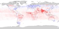
Satellitengestützte Klimabeobachtungen liefern die Grundlage, um Modellvorhersagen zu überprüfen und deren Qualität, Glaubwürdigkeit und Aussagekraft zu verbessern. Die ESA Climate Change Initiative umfasst mehrere Projekte, welche die Zusammenarbeit zwischen den Bereichen Erdbeobachtung und Klimamodellierung stärken. Ziel ist es, die wissenschaftliche Nutzung satellitengestützter Klimadatensätze für Modellassimilation, Kalibrierung und Parametrisierung zu erleichtern und so zu einem besseren Verständnis sowie verbesserten Vorhersagen beizutragen.

Darüber hinaus betreibt die ESA das CMIP International Project Office des Coupled Model Intercomparison Project, das unter der Schirmherrschaft des World Climate Research Programme globale Aktivitäten in den Bereichen Modellierung, Daten und Beobachtungen koordiniert.

Observations and climate modelling research

These research projects facilitate the development, and utilisation, of satellite-based climate data products (ECVs) to better constrain and validate climate models used to understand past and predict future climate change.

card image

Anwendergruppe Klimamodellierung (CMUG)

Verknüpfung von Klimamodellierern und Satelliten-Erdbeobachtungsexperten im Rahmen des CCI-Programms.

Projekt besuchen
card image

Climate and Marine Production (CAMP)

Advancing ocean productivity modelling and its response to climate change

Projekt besuchen
card image

Climate Observation and Modelling Expertise Team (COMET)

Advancing ocean & sea ice modelling using ESA CCI climate data to support CMIP7 and the next IPCC assessment cycle

Projekt besuchen
card image

PIRAMID

Progress in the Interpretation of Remotely-sensed Atmospheric Climate using Modelling, Inversion and Data assimilation

Projekt besuchen
card image

PISCO

Processes for Ice Sheets in Climate models and Earth Observation

Projekt besuchen

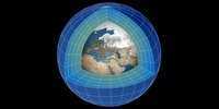
Climate modelling coordination

ESA co-hosts coordinating hubs for two major WCRP climate modelling initiatives that provide major contributions to IPCC assessments and regional adaptation planning.

card image

CMIP International Project Office

The International Project Office coordinates the Climate Model Intercomparison Project which provides climate projections to understand past, present and future climate changes.

Projekt besuchen
card image

CORDEX International Project Office

The co-ordinating hub of the WCRP’s Coordinated Regional Climate Downscaling Experiment

Projekt besuchen

CMIP forcing dataset projects

These project are developing enhanced observation-driven climate forcing datasets as inputs to the Coupled Model Intercomparison Project (CMIP) and improve the accuracy of historical climate simulations and future projections used in IPCC assessments.

card image

CMIP forcing - GHG concentrations

This project is developing new methods to create climate model inputs from ice cores, ground-based and satellite observations to improve greenhouse gas data input to Coupled Model Intercomparison Project.

Projekt besuchen
card image

CMIP forcing - ozone

Using satellite data to improve climate models by capturing past and future ozone changes for more reliable projections

Projekt besuchen
card image

CMIP forcing - volcanic

The project is producing stratospheric aerosol optical properties and volcanic stratospheric sulphur emission datasets from 1750 to present-day. They are key for climate model simulations run as part of the Coupled Model Intercomparison Project and feed into IPCC assessments.

Projekt besuchen