
Projekte
Im Rahmen des Programms Klimawandel-Initiative (CCI) der Europäischen Weltraumorganisation gibt es 26 wesentliche Klimavariablen-Projekte (ECVs). Informationen über die einzelnen ECVs, einschließlich ihrer Ziele, Teammitglieder, Nachrichten, Dokumentation, Daten und mehr, finden Sie bei den unten aufgeführten Projekten.

Aerosol
Das Aerosol-Projekt bietet unabhängig validierte, qualitativ hochwertige Algorithmen für die Verarbeitung langfristiger Aufzeichnungen globaler Aerosoleigenschaften von europäischen Satelliteninstrumenten.
Projekt besuchen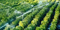
Anthropogenic Water Use
Developing a precursor satellite product to address the Anthropogenic Water use Essential Climate Variable
Projekt besuchen
Biomasse
Das Biomasse-Projekt liefert globale Karten der oberirdischen Biomasse für vier Epochen (Mitte der 1990er Jahre, 2010, 2017 und 2018), die eine Quantifizierung der Biomasseveränderungen ermöglichen.
Projekt besuchen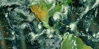
Cloud
Generating long-term and coherent cloud property datasets that exploit multiple Earth observation missions
Projekt besuchen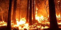
Fire
The FireCCI project aims to improve consistency, using better algorithms for both pre-processing and burned area detection while incorporating error characterisation.
Projekt besuchen
Greenhouse Gases (GHGs)
The Greenhouse Gas (GHG) CCI+ project aims to further develop retrieval algorithms needed to generate new high quality satellite-derived CO2 and CH4 atmospheric data products.
Projekt besuchen
Glaciers
The main objective of the Glaciers CCI project is to contribute to the efforts of creating a globally complete and detailed glacier inventory as requested by GCOS.
Projekt besuchen
High Resolution Land Cover
The HR Land Cover CCI studies and investigates the role of the spatial resolution of land cover and land cover change in supporting climate modelling research at regional scale.
Projekt besuchen
Ice Sheets (Antarctic)
The Antarctic Ice Sheet project develops methods for producing long-term and reliable climate data records of Antarctica from satellite observations.
Projekt besuchen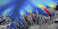
Ice Sheets (Greenland)
The Greenland Ice Sheets project produces data products of five ECV parameters, which are important in characterizing the Greenland Ice Sheet
Projekt besuchen
Lakes
The overarching objective of the Lakes project is to produce and validate a consistent data set of the variables grouped under the Lakes ECV.
Projekt besuchen
Land Cover
The Land Cover project critically revisits all algorithms required for the generation of a global land product in the light of GCOS requirements.
Projekt besuchen
Land Evaporation
Generating long-term global land evaporation records using Earth observation data
Projekt besuchen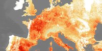
Land Surface Temperature
The project aims to provide an accurate view of temperatures across land surfaces globally over the past 20-25 years.
Projekt besuchen
LOng-LIved greenhouse gas PrOducts Performances (LOLIPOP)
A CCI project to assess the state-of-the-art satellite measurements of 'other long-lived greenhouse gases'
Projekt besuchen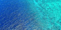
Ocean Colour
This project focuses on the Ocean Colour ECV encompassing water-leaving radiance in the visible domain, derived chlorophyll and inherent optical properties and utilises data archives from Copernicus, ESA, NASA and NOAA.
Projekt besuchen
Ocean Surface Heat Flux
Developing a total Ocean Surface Heat Flux data record, a key variable in understanding Earth’s energy balance
Projekt besuchen
Ozone
The Ozone project focuses on the generation of multi-decadal time series of harmonised and consistent ozone data suitable to assess long-term changes in total ozone, as well as its vertical distribution.
Projekt besuchen
Permafrost
This project is developing permafrost time series maps as Essential Climate Variable products primarily derived from satellite measurement
Projekt besuchen
Phytoplankton biomass and diversity Climate Change Initiative (PHYTO-CCI)
Developing satellite-based data products for phytoplankton carbon biomass and pigment diversity
Projekt besuchen
Precursors for aerosols and ozone
developing long term, satellite-derived climate data records for the Precursors for Aerosol and Ozone Essential Climate Variable
Projekt besuchen
River Discharge
This project aims to produce and validate a consistent data set of the variables grouped under the River Discharge Essential Climate Variable
Projekt besuchen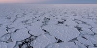
Sea Ice Age and Drift (SAGE)
Creating the first global data records of sea ice age and drift to support climate research
Projekt besuchen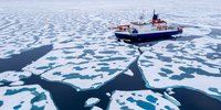
Sea Ice
The project aims to advance the retrieval capability for two main variables of the Sea Ice Essential Climate Variable (ECV): Sea ice concentration and sea ice thickness.
Projekt besuchen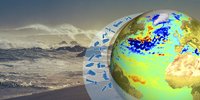
Sea Level
The Sea Level CCI project's main objective is to produce and validate a Sea Level Essential Climate Variable (ECV) product. This is achieved through four supporting aims.
Projekt besuchen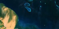
Sea Level Budget Closure
This project aims to reduce current uncertainties of sea level change and its individual components, resulting in better closure of the sea level budget.
Projekt besuchen
Sea State
The Sea State project is developing an 18-year data set (2002-2020) capitalising on the rich satellite altimeter, SAR imager, and other data holdings available during that period.
Projekt besuchen
Sea Surface Salinity
Generating improved calibrated global Sea Surface Salinity fields from all available satellite L-band radiometer measurements.
Projekt besuchen
Sea Surface Temperature
The project aims to make climate data records for SST longer, more stable and more accurate, providing data users with different forms of data and documentation.
Projekt besuchen
Snow
The Snow project generates long-time series of daily global snow extent maps from optical satellite data and daily global snow water equivalent products from passive microwave satellite data.
Projekt besuchen
Soil Moisture
The project generates long-term global soil moisture records that contribute to hundreds of hydrological and climatological studies worldwide, as well as the annual BAMS "State of the Climate" reports.
Projekt besuchen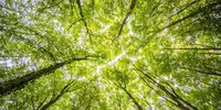
Vegetation Parameters
The Vegetation Parameters project of the ESA Climate Change Initiative
Projekt besuchen
Water Vapour
The Water Vapour project is generating new global high-quality climate data records of both total column and vertically resolved water vapour
Projekt besuchen