

Summary
The Brazilian CO₂, CH₄ and N₂O Large-Scale Experiment (BRACCIOLE) is an ESA-funded field campaign that investigates greenhouse gas sources, sinks and transport processes across the Amazon Basin and Pantanal wetlands. As part of DLR’s wider CoMet 3.0 Tropics initiative, it addresses critical observation gaps and provides data to support the development and validation of current and future greenhouse gas satellite missions.
Through a combination of ground, airborne and satellite observations, BRACCIOLE provides vital “ground truth” data that improves the accuracy and reliability of Earth observation products. Together with the complementary CarbonARA campaign, it helps reduce uncertainties in our understanding of carbon dioxide, methane and nitrous oxide exchanges in tropical ecosystems, which are among the most important yet challenging regions on Earth to monitor.
By strengthening the evidence base for greenhouse gas monitoring and verification, BRACCIOLE contributes to the wider scientific effort supporting climate action and the implementation of the Paris Agreement.
Background
ESA-supported field campaigns bring scientists, satellites, aircraft and instruments together on the ground, at sea and in the air to collect real-world measurements that address knowledge and observation gaps while also playing an important role in validating and improving Earth observation data products.
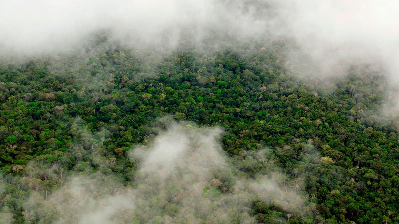
The BRACCIOLE campaign aims to generate a unique detailed dataset to describe natural and anthropogenic greenhouse gas sources, sinks and transport processes across tropical South America and the Amazon basin. This region plays a critical role in regulating the Earth's climate, yet large uncertainties remain in our understanding of how carbon dioxide (CO₂), methane (CH₄) and nitrous oxide (N₂O) are exchanged between tropical landscapes and the atmosphere. Persistent cloud cover limits the effectiveness of passive remote sensing while ground observations are limited.
This campaign - a complementary component of the of DLR’s CoMet 3.0 Tropics initiative - will help to better constrain carbon fluxes and budgets of tropical ecosystems – and improve regional carbon models. It will also better characterise the emissions from biomass burning. As well as addressing observation gaps, the campaign aims to provide valuable information to support the development of carbon models and validate current and future greenhouse gas satellite missions.
Aims and objectives
The campaign strengthens the evidence base for greenhouse gas monitoring and verification, which contributes to the wider scientific effort supporting climate action and the implementation of the Paris Agreement. It also contributes to ESA’s Earth Observation Science Strategy by addressing critical knowledge and observation gaps in the ‘global carbon cycle and chemistry’, helping to reduce uncertainties in natural and anthropogenic fluxes of carbon, methane and nitrous oxide.
Specifically the campaign has four main scientific objectives:
- Quantification of the spatial variability of atmospheric CO2 and solar induced florescence (SIF) - a proxy measure of photosynthetic activity - and data generation to improve estimates of carbon uptake and release by tropical vegetation.
- Quantification of the spatial variability major tropical wetland systems across the target area and investigation of relevant drivers, including hydrology, weather conditions and human influences. In addition use of these data to better understand and model tropical CH4 emissions.
- Assessment of biomass-burning plume composition to better quantify the CO₂ and CH₄ emissions ratio and improve understanding of greenhouse gas emissions from tropical fires.
- Quantification of the spatial distribution and vertical structure of atmospheric N₂O at local and regional scales. Dedicated measurements will help identify emission hotspots and improve understanding of this important greenhouse gas in tropical environments.
Advanced objectives are the usage of the data to evaluate model output and to quantify and verify greenhouse gas fluxes. The atmospheric concentration gradients shall also be linked to surface information such as albedo, photosynthesis, flaming fire, water coverage, etc. and to satellite data.
Study area
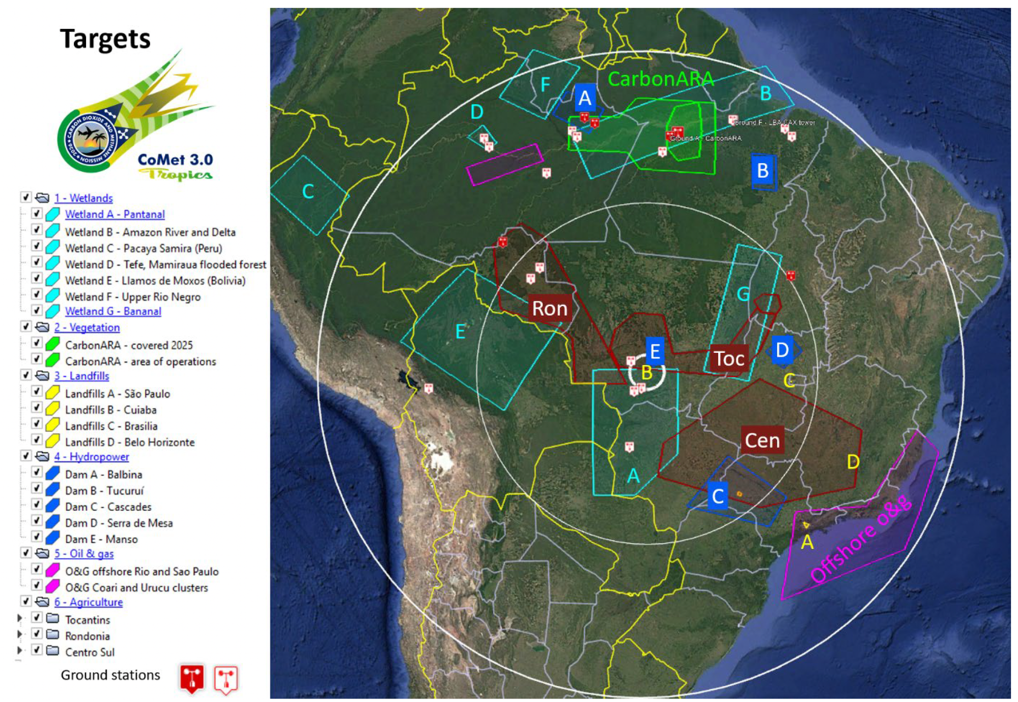
The BRACCIOLE and CoMet 3.0 Tropics campaigns focus on a representative range of natural and human-influenced environments to improve our understanding of carbon across the humid South American tropics and the Amazon basin. These include intact and disturbed Amazon rainforest, agricultural and degraded landscapes, and fire-prone tropical ecosystems, and anthropogenic emissions hotspots. An overview of the target sites and areas under investigation are shown in the map [below].
The target areas are described as follows:
- Biomes and biomass burning (supporting objective 1 and 3): flights over primary and secondary Amazon forest sites will combine with ground-based measurements to capture greenhouse gas fluxes, ecosystem change and fire impacts across tropical biomes. Ground measurements at the ATTO tower, near Manaus and around Santarém, supported by ESA’s CarbonARA campaign, will help characterise carbon dynamics across intact forest, degraded land and agricultural areas. Measurements over the Cerrado, a fire- and land-use-influenced tropical savanna covering nearly a quarter of Brazil, will improve understanding of regional greenhouse gas fluxes and fire-related carbon dynamics.
- Wetlands (supporting objective 2): measurements of natural methane emissions across the Pantanal wetland complex, one of the world’s largest tropical wetland system are planned. Covering160,000 km² of Brazil it is a significant methane source. Other possible areas of interest include Ilha do Bananal in Brazil and the Llanos de Moxos and Rio Mamore floodplains in north-eastern Bolivia.
- Anthropogenic emission hotspots (supporting objective 4): methane and carbon dioxide emissions from various human activities will be investigated including hydropower reservoirs, waste facilities, agriculture, livestock production and oil and gas infrastructure. These observations will help distinguish anthropogenic emissions from natural sources and support independent verification of emission estimates.
Observation set up
The BRACCIOLE campaign is scheduled from July to early September 2026 and will take measurements from a variety of instruments on board satellites, aircraft and on the ground networks.
Airborne observations
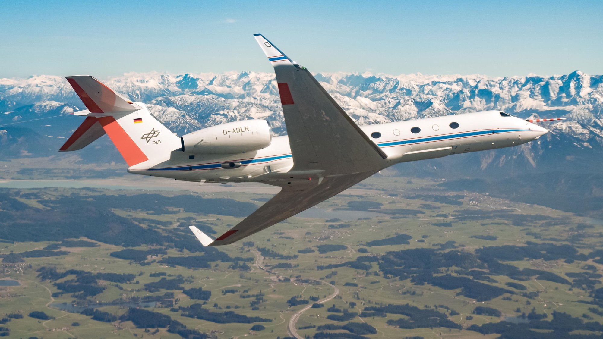
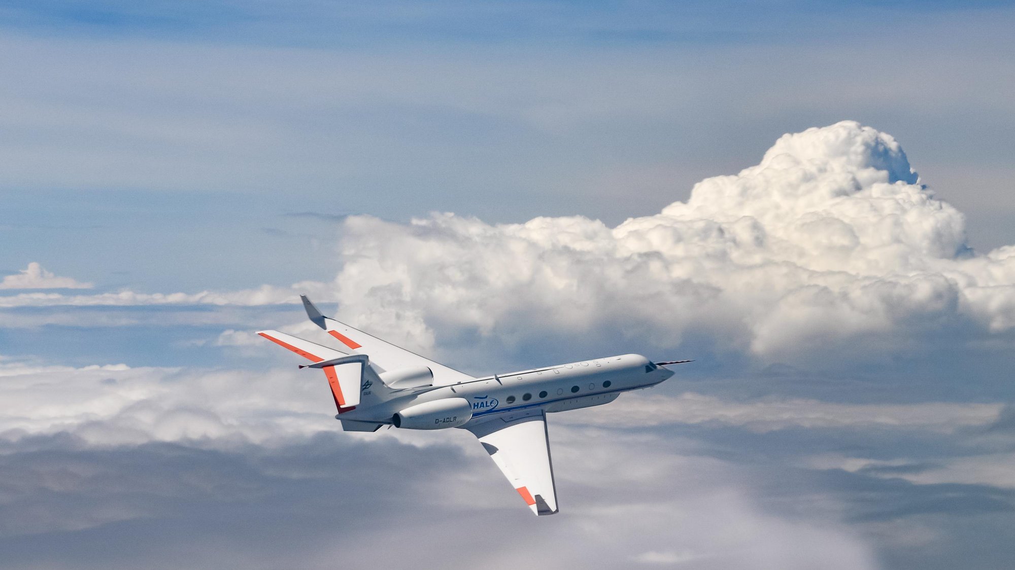
The High Altitude and Long Range Research Aircraft; type: Gulfstream G550 (HALO), is operated by DLR and has an endurance of up to 10 h and a maximal flight speed of around 250 m/s, making it well suited to measure large scale concentration gradients of greenhouse gases over targeted and large areas. HALO enables the deployment of several airborne sensors. The main instruments including:
- Methane Airborne MAPper - 2D greenhouse gas imager instrument (MAMAP2D) An airborne imaging spectrometer, developed by the Institute of Environmental Physics at the University of Bremen, maps atmospheric concentrations of CO₂, CH₄ and O₂ at high spatial resolution, enabling scientists to detect and quantify greenhouse gas sources and emissions.
- MIRO MGA. This Institute of Atmospheric Physics deployed gas analyser measures multiple atmospheric trace gases, helping scientists quantify greenhouse gas emissions and understand fire-related emissions.
- CHARM-F. An airborne lidar system to measure columns of CO2 and CH4 (XCO2 and XCH4), developed at DLR. It is currently the only airborne lidar system worldwide capable of measuring both, CO2 and CH4. CHARM-F’s provides the ability to measure independently of thin clouds (e.g. cirrus) and aerosol (such as in fire plumes) and also the capability to measure over water bodies.
Ground based infrastructure
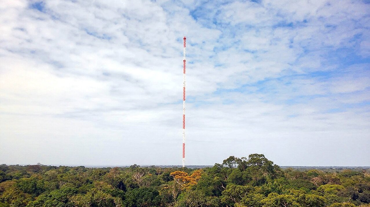
The campaign will make use of existing ground-based measurement infrastructure to support the characterisation of carbon fluxes, vegetation dynamics and land-use change impacts including the following:
- ATTO tower, Manaus. Located at 2.145933°S, 59.005583°W, measures GHG fluxes in undisturbed rainforest in the Central Amazon area. The tower is part of the Large Scale Biosphere-Atmosphere Experiment in Amazonia (LBA), consisting of a network of relevant monitoring sites across Brazil. These sites are mainly located in Amazonia with two stations in the Pantanal region.
- Secondary forest site, Santarém KM67: 2.8567°S, 54.9589°W). Overpasses and measurements from two EM27 ground stations will be made from an experimental farm belonging to the Federal University of Western Pará operated by UFOPA. The farm is located near Santarém, Pará State with a surrounding area representing a full range of land cover types (agriculture, secondary and intact forests). The area is the base of the closely aligned ESA-funded CarbonARA campaign, which has also identified a second measurement site near Santarem (2.683694°S, 54.535083°W). HALO will mimic flights which took place in September and October 2025 to observe fire emissions.
- Total Carbon Column Observing Network, Porto Velho: Total Carbon Column Observing Network measuring site close in Porto Velho, equipped with a Bruker IFS 125HR spectrometer in 2023. It is located at the Campus of Instituto Federal de Educacao, Ciencia e Tecnologia de Rondonia (8.7742°S, 63.8721°W), and is the only station of its kind in Brazil.
Satellite observations

The BRACCIOLE campaign supports and will provide reference observations for greenhouse gas satellite missions operating in tropical regions where cloud cover often limits data availability. Campaign measurements will support the validation and scientific exploitation of missions with regular coverage of South America delivering at least CH4 and CO2 will be assessed and validated as part of campaign activities including:
- Copernicus Sentinel-5P
- Copernicus Sentinel-5; and
- JAXA's GOSAT-1, GOSAT-2 and GOSAT-GW missions.