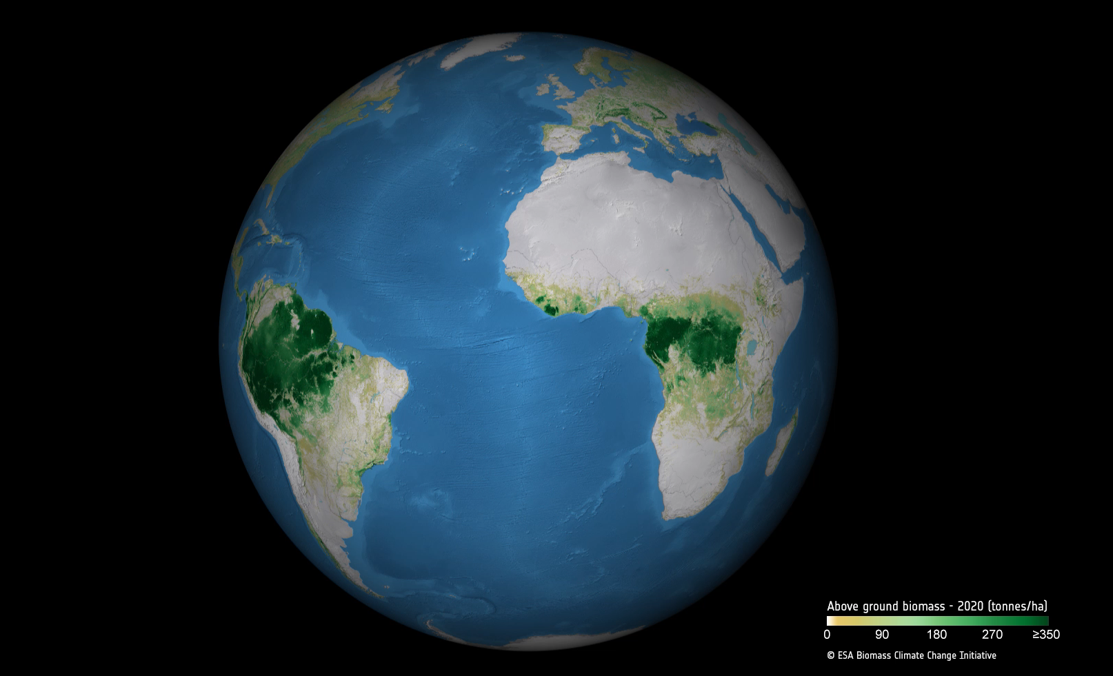
Expanding and restoring forests presents an opportunity for countries to remove carbon from the atmosphere and contribute to national efforts towards achieving net zero. Yet, reliable information that will enable policy-makers and scientists to track changes in forest cover and forest carbon stocks over time at both national and global scale has not been available until now.
The latest iteration – version 4.0 – of ESA’s above ground biomass dataset, which harnesses satellite observations and was developed by scientists working as part of its Climate Change Initiative (CCI), makes it possible for the first-time to robustly monitor fluctuations in the forest carbon stock.
Large-scale, above ground biomass maps already exist. For example the CCI biomass research project team produced global information at 100m spatial resolution for five annual epochs - 2010, 2017, 2018, 2019 and 2020. These maps however, do not allow biomass change to be quantified between years, in part due to different satellites were in orbit in 2010 compared with the later epochs affecting the type and format of the imagery provided and hence the ability to estimate above ground biomass from that data.
The project team, led by Professor Richard Lucas of Aberyswyth University, overcame this problem as part of a collaborative effort between ESA’s Climate Change Initiative and the Japan Aerospace Exploration Agency (JAXA). The latter making dedicated data and processing high-volume L-band SAR data from the Advanced Land Observing Satellite (ALOS and ALOS-2) missions available for inclusion in the global above ground biomass maps.

Professor Lucas explains, “L-band SAR from ALOS, provides excellent penetration of the forest canopy, by combining it with C-band SAR acquisitions from ESA’s Envisat and Sentinel-1 satellites we improve calibration across the different years and this provides the fundamental basis for our consistent high-quality biomass maps.
“The collaboration between ESA’s Climate Change Initiative and JAXA has helped make a significant advance. We now have an Earth observation dataset with more reliable estimates to really investigate and quantify biomass and biomass change at a global level.”
The dataset’s release is timely given the first Global Stocktake (GST) which is set to be completed during COP28 in the United Arab Emirates later this year and aims to review collective progress towards limiting global warming below 2 degrees Celsius, and ideally 1.5 degrees Celsius (relative to the pre-industrial period).
Including the new and more robust global forest biomass data in the stocktake will help to establish – and quantify – with great greater certainty, the net gains and losses of carbon associated with forest growth, loss and degradation. In turn, this will inform and guide the extent of mitigation actions by countries and the global community.
Dr. Maurizio Santoro (GAMMA), part of the ESA biomass project team and key to the new maps’ generation adds that “version 4.0 provides biomass change, along with quality flag indicators for annual increments from 2017 to 2020 while also shedding light at the decadal scale between 2010 and 2020. Adding more years of data to the current time series will enable an even more precise quantification of terrestrial carbon dynamics and provide policy makers with more accurate information relating to carbon reduction decision-making.”
Dr. Takeo Tadono of JAXA, and research manager of the ALOS mission series, adds “On behalf of JAXA, we sincerely appreciate the enormous efforts of ESA’s Climate Change biomass project team in completing the global biomass maps for five time periods. This dataset demonstrates the importance of satellite earth observation and their expected contributions to climate change research and to our understanding of the geospatial distribution of forest carbon storage.”
The new maps are sufficiently robust to be used by policy-makers and climate and carbon cycle scientists. They have been fully validated and uncertainty characterised using ground-based data from various sources including National Forest Inventory (NFI) samples and high quality (typically 100 x 100 m or 1 hectare) research plots from forests representing the world’s major biomes.
The above ground biomass dataset is produced as part of the ESA Climate Change Initiative, which harnesses Earth observation data from ESA and third-party missions to generate a suite of long-term and consistent records to address Essential Climate Variables that are needed to understand and address key aspects of the climate.
The release of this data set has been announced to the global forest community during the GFOI Plenary 2023 at FAO in Rome. To access the data, visit the ESA CCI Open Data Portal.

