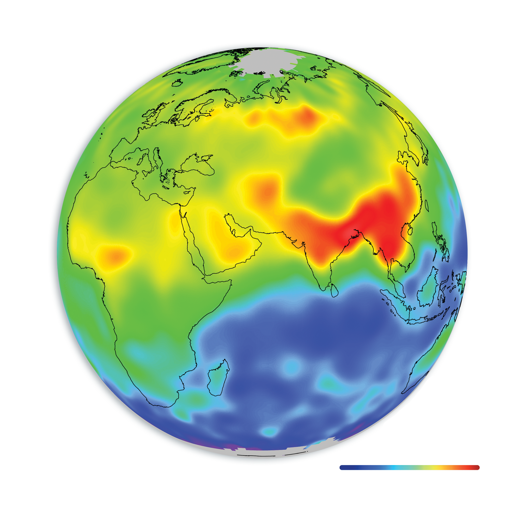
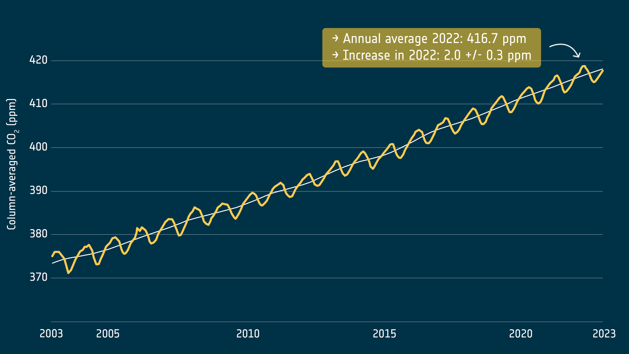
Levels of carbon dioxide and methane in the atmosphere – the primary drivers of human-induced climate change – are at record levels and continue to rise.
Satellites are used to detect the smallest change in atmospheric concentration. They show carbon dioxide rose to 416.7 ppm by the end of 2022, while methane concentrations are now around 150% above pre-industrial levels – and continue to rise.
By accurately detecting these small changes – to within 1 part per million for carbon dioxide – satellite observations are helping the scientific community to improve global climate models and better predict the likely warming effect and impacts resulting from increased levels of greenhouse gases in the atmosphere.
ESA's Climate Change Initiative Greenhouse Gas project is mapping the global distribution of near-surface carbon dioxide and methane. The team undertaking research to improve on the current operational products initially developed by the Climate Change Initiative, but now transferred and extended annually by the EU’s Copernicus Climate Change Service.
The project team is continually developing retrieval algorithms to incorporate data form the latest generation of satellites, including the Copernicus Sentinel-5P mission, NASA's Orbiting Carbon Observatory (OCO-2), and the China National Space Administration’s TanSat mission to observe these greenhouse gases in the greatest detail yet. These satellites provide even higher resolution data and are equipped with the ability to distinguish between natural and human sources of carbon dioxide and methane and in turn support emissions reduction policies such as the Paris Agreement that are addressing global warming.
Access satellite-derived greenhouse data
- Access most advanced, research-ready global datasets and algorithms for carbon dioxide and methane from the Climate Change Initiative's Open Data Portal
- Operational datasets, for carbon dioxide and methane that are temporally updated can be accessed from the Copernicus Climate Change Service