The important contribution of Earth observation satellites in understanding the state of the changing global climate system and supporting mitigation and adaptation efforts was underscored by the leading scientific advisory body to the UNFCCC at COP29 in Baku, Azerbaijan.
The summary report, produced by the Subsidiary Body for Scientific and Technological Advice (SBSTA) reflects updates given by the systematic observations community including the World Meteorological Organization (WMO), the Global Climate Observing System (GCOS) during the COP29 dedicated Earth Information Day.
The SBSTA report reiterated concern regarding record levels of atmospheric greenhouse gases, rising temperatures and the onset of extreme events and the urgent need to expand observations in support of adaptation.
During this year’s international climate discussions ESA promoted examples where satellite missions provide insights reflecting the themes in the SBSTA report, most notably alongside other space agencies to delegates, climate experts and NGOs on the Azerbaijan host' and the Science in climate action pavilions.
From Space to Earth: Data for Decision-Making
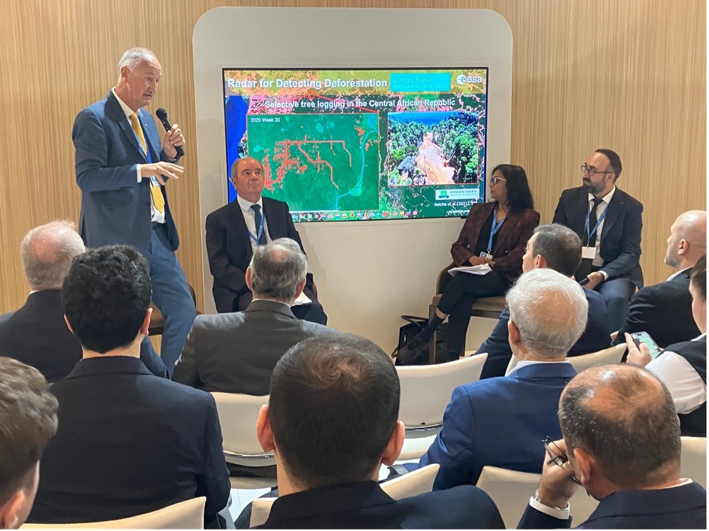
At the Azerbaijan pavilion, ESA’s Frank-Martin Seifert emphasised how the Copernicus Sentinel satellites, which generate 30 terabytes of open-access data daily, are equipping Governments with the capability to deliver on their climate commitments.
Dr. Seifert cited the radar capabilities of Copernicus Sentinel-1in supporting near real-time detection of small-scale disturbances and deforestation in tropical forest regions. The satellite’s observations make it possible to accurately detect and monitor changes even under persistent cloud cover to support initiatives like Global Forest Watch, aiding national stakeholders responsible for sustainable forest management.

Long-Term Observations and Emerging Trends
Moving to the oceans, Dr Seifert revealed the rising global mean sea level trend. He noted that the overall upward trend is at 3.7 mm per year but has accelerated in recent years to 4.8 mm per year. These insights, derived from over three decades of satellite altimeter data, highlight regional disparities in sea-level impacts and form the basis for regional and national planning to protect coastal communities. Moving forwards, new missions, such as already operational Copernicus Sentinel-6and CRISTAL, another Copernicus Sentinel Expansion mission, planned for launch in 2027, will extend the sea level record, providing higher-resolution coastal data for improved resilience planning.
Disaster charter: global climate resilience
The International Charter on Space and Major Disasters was highlighted as a global initiative that enhances global climate resilience. Established in 2020 with ESA as a founding member, the Charter leverages data from satellites including Copernicus Sentinel-1 and Sentinel-2 missions. The Charter now comprises 17 space agencies and provides free satellite data to aid emergency responses to natural and technological disasters worldwide.
Dr Seifert highlighted how radar data has been used to map flood extent in West Brazil to aid civil protection agencies and put the impact of the Charter, which offers 24/7 operational support into context.
‘Since 2020, the Charter has been activated more than 900 times across 161 countries, offering vital support in addressing disasters like floods, storms, and earthquakes,” explained Dr Seifert.
Space for climate action
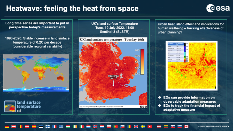
ESA’s Clement Albergel provided a keynote at the Science for Climate Action pavilion, emphasising how satellites contribute to addressing the "triple planetary crisis" of climate change, pollution, and biodiversity loss. He pointed to the significant progress made in generating a suite of stable, satellite records that address GCOS-defined Essential Climate Variables. Over 25 datasets have been developed by ESA’s Climate Change Initiative and not only form a major element of the global climate observing system but also form the key lines of evidence on the state of the climate that are detailed in the IPCC's sixth assessment report.

Dr Albergel used his presentation to highlight how satellite data can be used to inform climate adaptation policy and action. In an urban context, he showed how space-derived land surface temperature observations and records have the potential to characterise the extent and intensity of extreme events such as heatwave as well as tracking progress and impact of how green and blue infrastructure can alleviate heat stress and support the well-being of urban populations.

With global adaptation efforts lagging, Dr Albergel called for Earth observation satellites to be further exploited and pointed to a future plan to explore EO-based adaptation indicators that will be outlined in a forthcoming joint white paper from the International Space Science Institute, with community input in 2025.
Dialogues initiated during COP29 have set the stage for innovative, data-driven observations approaches to support the urgent acceleration needed on both mitigation and adaptation fronts over the vital next decade.

