
About
Lakes and enclosed inland seas are integrators of environmental and climatic changes occurring within their contributing basins. Factors driving lake condition vary widely across space and time, and lakes, in turn, play an important role in local and global climate regulation, with positive and negative feedback depending on the catchment. Understanding the complex behaviour of lakes in a changing environment is essential to effective water resource management and mitigation of climate change effects.
Lakes have been observed as sentinels of climate change, both directly and indirectly through watershed changes. Lakes integrate responses over time and studies of globally distributed lakes can capture different aspects of climate change. Therefore, a global and consistent climate data record of lakes is essential to mitigate and adapt to climate change.
The Lakes_cci project develops satellite-derived products for the Lakes Essential Climate Variable, as defined by GCOS-200:
- Lake Water Level (LWL): fundamental to understand the balance between water inputs and water loss.
- Lake Water Extent (LWE): a proxy for change in glacial regions (lake expansion) and drought in many arid environments, water extent relates to local climate for the cooling effect that water bodies provide.
- Lake Surface Water temperature (LSWT): correlated with regional air temperatures and a proxy for mixing regimes, driving biogeochemical cycling and seasonality.
- Lake Ice Cover (LIC): freeze-up in autumn and advancing break-up in spring are proxies for gradually changing climate patterns and seasonality.
- Lake Ice Thickness (LIT): a driver of seasonal lake biogeochemistry and early indicator of changing lake thermodynamics. This product, is being evaluated and upscaled during the current project phase.
- Lake Water-Leaving Reflectance (LWLR): a direct indicator of biogeochemical processes and habitats in the visible part of the water column (e.g. seasonal phytoplankton biomass fluctuations), and an indicator of the frequency of extreme events (peak terrestrial run-off, changing mixing conditions).
Objectives
The overarching objective of the Lakes project is to produce and validate a consistent data set of the variables grouped under the Lakes ECV. This includes aiming for the longest period of combined satellite observations by designing and operating processing chains, designed to ultimately feature in a sustainable production system.
The main ambition associated with this objective is to establish wide uptake by a varied and fragmented landscape of potential users. This requires significant alignment of current practices for producing the individual Lake variables, cross-variable validation, and demonstration in the form of use cases. Successfully tackling the challenge of producing a single data set for the Lakes ECV creates an opportunity to move the science community towards wider uptake of Earth Observation data in limnological studies.
To achieve this global objective, the specific objectives for the Lakes project are to:
- Assess the requirements of the climate research community and thereby ensure consistency in the (further) development of the Lakes ECV processing system. The criteria will be revisited to propose complementary groups of lakes for each of the lake ECV products.
- Develop, test and select the best algorithms and standards to produce high quality Lake products for climate applications across sensors. A range of algorithms and methods will be assessed to yield the longest possible period of observations for each variable, and the largest possible subset of lakes for which a complete set of variables can be provided.
- Provide a specification of the operational production system, aligned with related activities in the Copernicus programme (e.g. Global Land Service, C3S). The system will include new algorithms developed and validated within the project to meet user requirements.
- Validate the Lake ECV products through the involvement of independent climate research groups. Five use case studies are proposed for the demonstration of products and their value to climate science and applications.
- Generate new interest in the EO climate data sets produced for inland water bodies within the community of limnologists, operating at local to global spatial scales and likely to use varying subsets of the Lakes ECV products.
Deriving the Lakes Essential Climate Variable (ECV) from satellite records requires the use of various remote sensing techniques including radar altimetry, thermal and optical sensing. The state-of-the-art used to produce the ECV products applies distinct sensor combinations and methodologies for calibration and validation for each product. The Lakes_cci team therefore consists of experts representing each remote sensing domain.
The purpose of this project is to revisit the algorithms required for the generation of each parameter, aiming to fulfil the GCOS requirements to the extent possible with modern and legacy sensors.
The Lakes_cci project has entered its second project phase under the ESA CCI+ programme. The first phase started in 2018 and was completed in 2022 and delivered two data releases and associated product documentation. The second phase started in June 2022 and will last three years.
The project is divided into two data processing phases composed of five steps each:
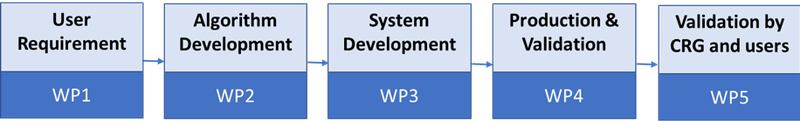
The distinct components of work are briefly summarized as follows:
WP1: User requirements: In coordination with the WP5 team, this work package is dedicated to analysis of end-user requirements, identifying multiple users and use cases and translating their needs into development tasks.
WP2: Algorithm development: The origin of algorithms used in the project to calculate the five parameters is two-fold:
- External algorithms identified as possible improvements for the Lakes product
- Algorithms conceptualised and developed within the project
In both cases, the algorithms are assessed, developed or adopted, and their associated uncertainty is estimated while end-products are validated through round-robin exercises.
WP3: System Development: The aim of this work package is to maintain and further develop prototype data processing systems to generate the ECV products. The Lakes_cci project is a distributed data processing infrastructure due to the wide suite of satellite input products and expertise required to generate the full ECV set.
WP4: Production Generation and Validation: Products are generated based on the algorithms analysed in WP2, taking the user requirements into account (WP1) and using the systems developed in WP3.
WP5: Assessment of the ECVs products: In this package of work we:
- Collect the requirements from different international frameworks that play a key role in monitoring and understanding climate change
- Assess and exploit the ECVs generated in WP5 through five use cases using the products generated
- Provide support and collect feedback from external users of the data set.
- Explore three use cases :
- Heatwave and storm events impatct on lakes
- Water quantity in relation to water quality in a changing environment
- Aggregated climate indicators for the global lakes dataset
During Phase 1 (2018-2022), five use cases were studied
- Analysis of ECVs for Greenland Lakes
- Analysis and interpretation of ECVs for larger lakes (LWLR, LWST)
- Exploiting ECVs in Long Term Ecosystem Research
- Brownification in Scandinavian lakes
- Consistency of ECVs in the Danube river-lake-lagoon
During Phase 2, two options are also explored:
- Retrieval of CDOM (Coloured Dissolved Organic Matter) as a proxy of dissolved carbon. The objective is to provide the means to generate a new lakes_cci product, complementing Chla and Turbidity products derived from LWLR.
- Sentinel Lakes of Sub-Sahelian Africa. The objective is to study an lake in detail, bringing lake-specific modelling and observations together to understand and describe the lake-climate interactions and likely consequences.