
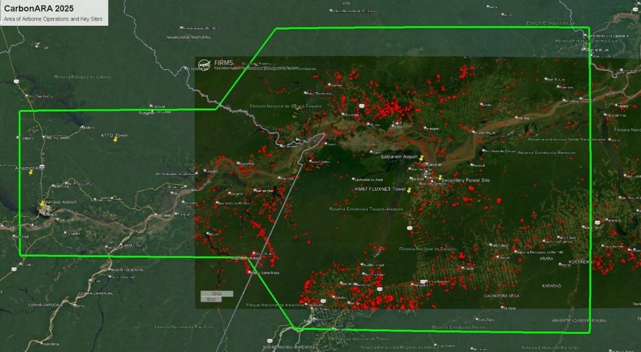
Experimental set up - in-situ measurements
The ground campaign incorporates installation of fixed-site instrumentation at two flux tower locations to observe GHG fluxes and vegetation-related variables. One is situated in the Tapajos National Forest (primary forest area) and a second site located at the UFOPA Experimental Farm to observe GHG fluxes in a secondary / degraded forest setting.
Instrument installation was completed prior to the airborne campaign and will take measurements extending from September 2025 into 2026 and potentially beyond to gather a full set of seasonal data.
Mobile, 'roving' measurements wil be taken to study fire events around Santarém area. Deployment locations will be guided by real-time fire satellite information, enabling responsive sampling of fire events to facilitate study these spatially and temporally variable events.
Fixed, ground observation sites
Primary forest site - LBA Tapajos KM67
The primary forest site (LBA Tapajos KM67), is located in the Flona Tapajos Forest - a 450,000 ha closed-canopy upland forest in Amazonian Brazil. The surrounding area has minimal anthropogenic disturbance and consists of 'old-growth' forest with a stand of predominantly uneven age distribution, emergent trees, numerous epiphytes and abundant large logs.A substantial scientific installation is already present at the site which will be enhanced with additional instrumentation as part of this project.
The site forms part of the braziian space agency (INPE)-led, Large-Scale Biosphere-Atmosphere Experiment in Amazonia. Pre-existing infrastructure includes a 65m flux tower with a range of atmospheric and environmental instrumentation and a 45m high ‘walk-up’ tower which currently hosts additional instrumentation for calibration purposes and is managed by UFOPA.
New campaign-specific instruments will be installed on the 45m tower (see table 1) to complement existing meteorology and remote sensing equipment to support ground-based proximal vegetation sensing.
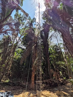
Table 1: Primary forest site: new instrumentation
| Instrument | Purpose | Manufacturer | Responsible organisation |
|---|---|---|---|
| L-Band Radiometer | VOD | TerraRadTech | TerraRadTech |
| FLoX | SIF radiance and indicies | JB Hyperspectral | JB Hyperspectral |
| GNSS | VOD | UPC | ESA |
| KT15.85 IIP thermal radiometers | LST | Heitronics | King's College |
Secondary forest site - Santarém
Secondary forest measurements will be made from an experimental farm belonging to the Federal University of Western Pará (UFOPA). It is located on the Santarém–Curuá–Una Highway (PA-370), km 37, in the municipality of Santarém, Pará State and covers an area of approximately 660 hectares with trees of up to ~47m height.
New instruments have been installed (see table 2) to complement apparatus from a number of colocated projects to this site. These include:
- SONDA Network Project (INPE – UFOPA), includes equipment related to solar and wind energy monitoring, as well as sensors for cloud cover, ozone, and ultraviolet radiation as part of INPE's national monitoring programme.
- AERONET System and Atmospheric Observatory, features a CIMEL spectrometer, allowing nighttime aerosol measurements in addition to traditional daytime measurements using solar radiation. This advancement is especially important for monitoring the increase in aerosols during the dry season, when fires are frequent in the Amazon region.
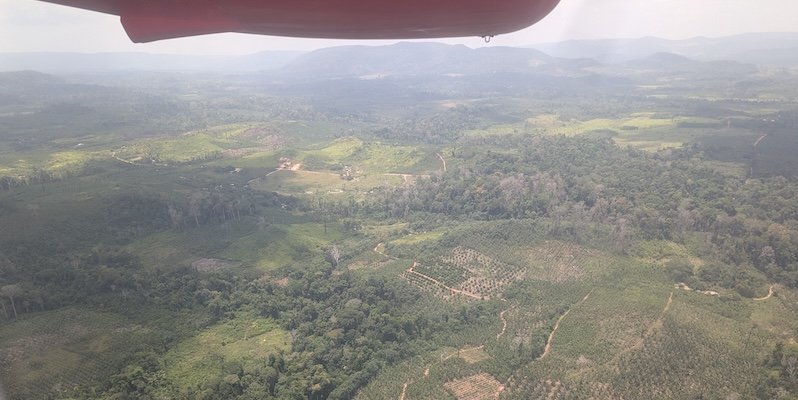
Table 2: Secondary forest site new instrumentation
| Instrument | Purpose | Manufacturer | Responsible organisation |
|---|---|---|---|
| Open path CH4 Analyser | Methane Analyser | LICOR | UFOPA |
| IRGASON | Energy Balance System | Campbell | UFOPA |
| FLoX | SIF | JB Hyperspectral | JB Hyperspectral |
| Spectrometer | Atmospheric trace gases | Pandora | ESA |
Mobile 'roving' ground based measurements
Satellite records indicate frequent fire activity - and thereby influencing variables such as GHG and aerosol emissions - around the time of the planned campaigns. Mobile ("roving") ground-based measurement equipment (see table 3) including UAVs, will be deployed around the Santarém area, guided by real-time satellite active fire detection with the aim of supplementing fire related information obtained by the airborne campaign.
Emissions factors measured close to the source on the ground can be compared to those measured from the airborne campaign to provide spatially and temporally supporting information to assess the impact of individual fire events.
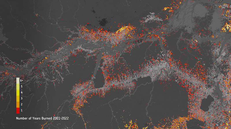
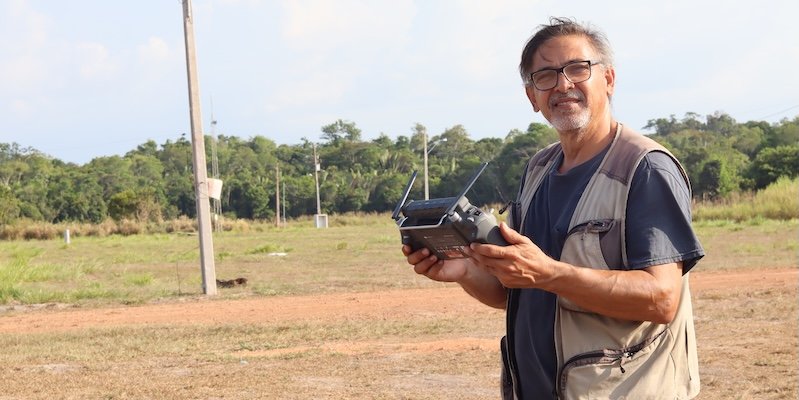
Table 3: Mobile smoke gas / particulate matter instrumentation
| Instrument | Purpose |
|---|---|
| Los Gatos Research Ultraportable | CO, CO2, CH4, and H2O |
| Aeris MIRA Pico | CO, N2O, CO2 (NDIR) |
| GasLabPro | CO2: NDIR CO: Electrochemical |
| TSI Dustrak II | Optical particulare matter analysis (0.1-10µm |
| TSI SidePak AM520 | |
| Sniffer4D mini | Particulate matter analysis PM1, PM2.5, PM10 up to 1000µm |
| Solarlight Microtops II | Aerosol Optical Depth |