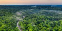
Humans have exploited forest biomass as a material and energy source for millennia, but population growth and increasing demand for resources have diminished the extent and condition of forests, with this impacting on the amount of carbon they store and exchange with the atmosphere. Increasingly, forests are being impacted by our changing climate. For this reason, the Global Climate Observing System (GCOS) considers above-ground biomass (AGB; expressed in tonnes per hectare) as an Essential Climate Variable (ECV). Information on forest biomass can also play a much wider role in understanding and predicting climate, for example in model initialisation and testing, estimating carbon turnover and inferring forest disturbance regimes, and through data assimilation in carbon cycle and climate models.
Objective
The primary science objective of ESA’s Climate Change Initiative (CCI) Biomass project is to provide global maps of above-ground biomass (Mg ha-1) annually for selected epochs (2007, 2010, 2015-2022) with these supporting quantification of biomass change.
Current mapping is at 100 m grid spacing with a target relative error of less than 20 per cent where AGB exceeds 50 Mg ha-1. Although this resolution is finer than required for current climate modelling, the information provided can be exploited by both climate and carbon cycle models as they develop.
About the project
The global maps of the above ground biomass of woody vegetation and changes over time have and continue to be generated from Synthetic Aperture Radar (SAR) data acquired at C-band by the European Space Agency's (ESA) Sentinel 1A & B and L-band by the Japan Aerospace Exploration Agency's (JAXA) Advanced Land Observing Satellites (ALOS PALSAR, ALOS-2 PALSAR-2). The retrieval algorithm is informed by information on forest height and cover density extracted from spaceborne LIDAR, including NASA's Global Ecosystem Dynamics Investigation Lidar (GEDI). The combination of these sensor types allows information on the amounts of foliage and woody plant material to be retrieved over time.
The mapping builds on algorithms developed initially through ESA's GlobBiomass Project, with these advanced through ESA CCI Biomass. The quality of the maps is assessed against existing and new ground and airborne data sets. The resulting global biomass data sets represent new information that can be used to support climate and carbon cycle modelling.
Explore ESA's global biomass data record
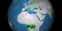
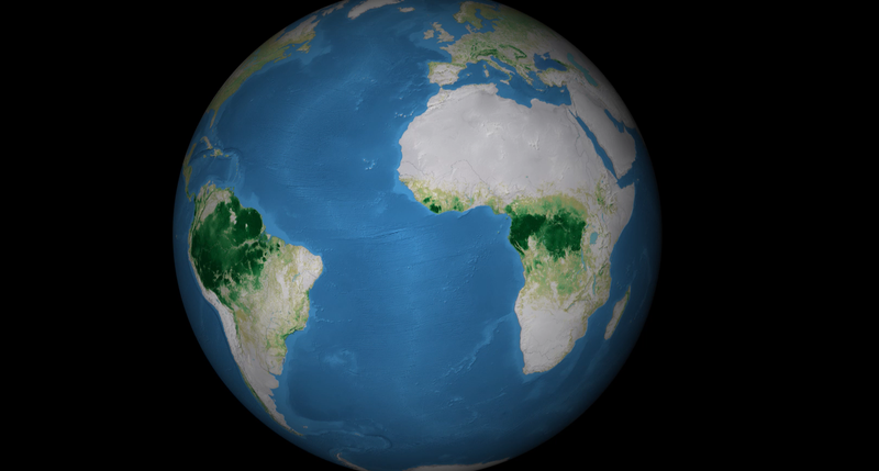
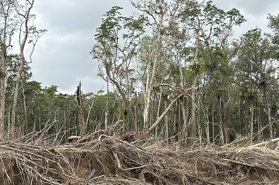
The global maps of AGB (tonnes or Mg per hectare) for 2010 and annually from 2015 to 2021 can be viewed here. Interactively rotate and zoom into the globe and/or press play to explore the World's forests. You might want to observe how AGB changes with latitude or elevation or within and between biomes, such as the tropical, temperate and boreal zones; or how levels of AGB have changed as a consequence of deforestion or wildfires.
Science outcomes
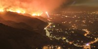
The global maps of AGB provided across multiple epochs are providing new insights into how the carbon contained within the World's forests, woodlands and shrublands is changing in response to human activities and natural events and processes, including those influenced by climate change. Explore some of the major outcomes and discoveries arising from the CCI Biomass project and the new avenues we are exploring.
Outreach and Education
ESA CCI Biomass is involved in many activities that are showcasing and promoting the use of the global AGB maps for understanding the states and dynamics of carbon in forests globally.
ESA CCI Biomass has hosted two Biomass Change Workshops to gather insights in how best to quantify carbon losses and gains from time-series of above ground biomass maps. A third Workshop is being held on the 4-5th February in Berlin, Germany. Please email richard.lucas@aber.ac.uk if you would be interested to attend online or would like details of outcomes following the meeting.
The Forest Session of the UK STEMs POP25 featured Professor Richard Lucas from Aberystwyth University and John Remedios from the National Centre for Earth Observation (NCEO), who showcased ESA's new BIOMASS mission, the ESA CCI times series of global biomass maps and efforts aimed at restoring forests across the World.
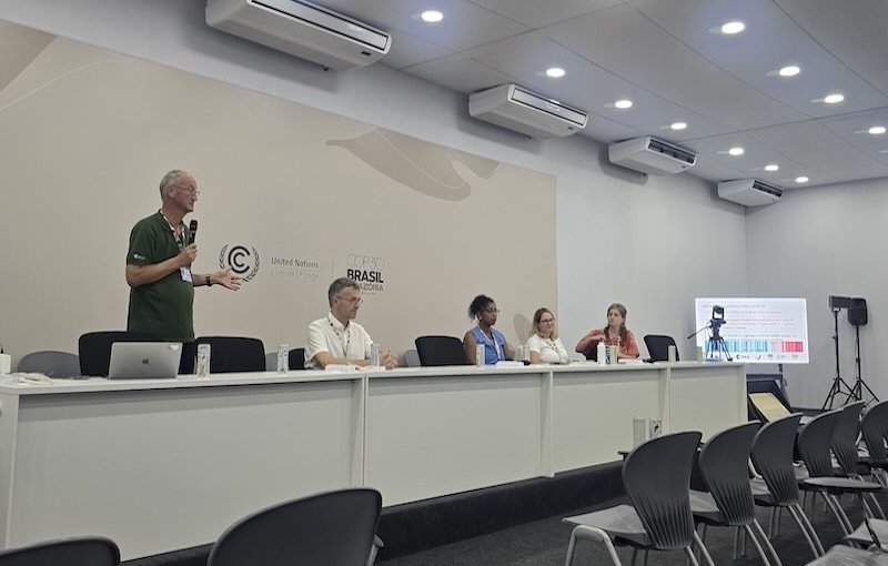
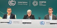
The State-of-the-Art Forest Monitoring was the topic of an ESA-led UNFCCC side event, opened by ESA’s Frank Martin Seifert and involving expert forest scientist, explored how advanced satellite missions such as ESA’s Biomass mission – launched in April of 2025 and equipped its novel P-band space-based radar – are revealing new insights into the dynamics of tropical forest carbon storage.
Access and search ESA Climate Change Initiative data products via our dedicated CCI Biomass data portal. Search for "above ground biomass" and the latest AGB maps (Version 6.0), which can be downloaded.
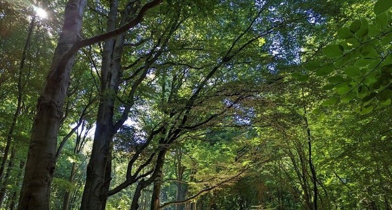
The above ground biomass (AGB) of vegetation is defined as the mass, expressed as oven-dry weight, of all plant components, including the wood (stem, bark, branches, twigs and above ground roots) and foliage. Stumps and below ground roots are excluded. The AGB of woody vegetation (trees and shrubs forming forests, woodlands or scrublands) is expressed in tonnes (t) or Megagrams (Mg) per hectare (ha-1).
ESA’s Climate Change Initiative (CCI) Biomass project currently provides global maps of AGB (Mg ha-1) at 100 m spatial resolution for 2007 and 2010 and annually from 2015 to 2022. Per-pixel estimates of AGB uncertainty, expressed as the standard deviation in Mg ha-1, are also provided.
AGB change maps (also expressed as Mg ha-1) are available for consecutive years (i.e., 2016-2015, 2017-2016, 2018-2017, 2019-2018, 2020-2019, 2021-2020, 2022-2021), over a decade (2020-2010) and for the period 2010-2007 are provided. A cost function that preserves the temporal features as expressed in the remote sensing data has been refined to limit biases between the 2007-2010 and maps generated from 2015 onwards. Each AGB change product consists of two sets of maps with these being the standard deviation of the AGB change and a quality flag of the AGB change. The change itself can be computed as the difference between two AGB maps and is therefore not provided.
Aggregated products of the AGB and AGB change data layers are available at coarser spatial resolutions (1, 10, 25 and 50km). Raster layers provided are AGB change between two consecutive years (i.e., 2016-2015, 2017-2016, 2018-2017, 2019-2018, 2020-2019, 2021-2020, 2022-2021), over a decade (2020-2010) and the period 2010-2007. Each AGB change product consists of two sets of maps: the standard deviation of the AGB change and a quality flag of the AGB change. Note that the change itself can be simply computed as the difference between two AGB maps, so is not provided directly. Data are provided in both netcdf and geotiff format.
Key reference: Santoro, M.; Cartus, O. (2025): ESA Biomass Climate Change Initiative (Biomass_cci): Global datasets of forest above-ground biomass for the years 2007, 2010, 2015, 2016, 2017, 2018, 2019, 2020, 2021 and 2022, v6.0. NERC EDS Centre for Environmental Data Analysis, 17 April 2025. doi:10.5285/95913ffb6467447ca72c4e9d8cf30501. https://dx.doi.org/10.5285/95913ffb6467447ca72c4e9d8cf30501
The ESA CCI Biomass team consists of leading scientists from 12 organisations in Europe. The project is led and managed by Professor Richard Lucas (University of Aberystwyth) and the Science Lead is Professor Shaun Quegan (Sheffield University).
To contact the CCI Biomass team email:
- Project Manager: Richard Lucas (University of Aberystwyth, UK)
- Project Coordinator: Anne Harris (University of Aberystwyth, UK)
- Science Leader: Shaun Quegan (University of Sheffield, UK)
- Alexandre Bouvet (Centre d'Etudes Spatiales de la Biosphère, France)
- Jérome Chave (Evolution et Diversité Biologique, France)
- Maurizio Santoro, Oliver Cartus and Andreas Wiesmann (Gamma Remote Sensing, Switzerland)
- Dmitry Schepaschenko (International Institute for Applied Systems Analysis, Austria)
- Christiane Schmullius and Carsten Pathe (Earth Observation Services Jena, Germany)
- Philippe Ciais, (Laboratoire des Sciences du Climat et de l'Environnement, France)
- Oliver Phillips (University of Leeds, UK)
- Heiko Baltzer, Nezha Acil (University of Leicester, UK)
- Martin Herold (GFZ Helmholtz Centre Potsdam, Netherlands
- ESA Technical Officer: Clement Albergel
To run this example yourself, go to https://dashboard.climate.hub-otc.eox.at/. You can register for free.
- Santoro M., Cartus, O., Quegan, S., Kay H., Lucas, R. M., Araza, A., Herold, M., Labrière, N., Chave, J., Rosenqvist, Å., Tadono, T., Kobayashi, K., Kellndorfer, J., Avitabile, V., Brown, H., Carreiras, J., Campbell, M. J., Cavlovic, J., Conceição Bispo, P., Gilani, H., Khan, M. L., Kumar, A., Lewis, S. L., Jingjing Liang, J., Mitchard, E. T. A., Pacheco-Pascagaza, A. M., Phillips, O. L., Ryan, C. M., Saikia, P., Schepaschenko, D., Sukhdeo, H., Verbeeck, H., Vieilledent, G., Wijaya, A., Willcock, S. and Seifert, F.M.. Design and performance of the Climate Chnage Initiative Biomass global retrieval algorithm. Science of Remote Sensing. 2024. https://doi.org/10.1016/j.srs.2024.100169
- Chen, N., Tsendbazar, N. E., Requena Suarez, D., Silva-Junior, C. H. L., Verbesselt, J., Herold, M.. Revealing the spatial variation in biomass uptake rates of Brazil’s secondary forests.. ISPRS Journal of Photogrammetry and Remote Sensing. 2024. https://doi.org/10.1016/j.isprsjprs.2023.12.013
- Hunka, N., Santoro, M., Armston. J. et al.. On the NASA GEDI and ESA CCI biomass maps: aligning for uptake in the UNFCCC global stocktake.. Environmental Research Letters. 203. https://doi.org/10.1088/1748-9326/ad0b60
- Dalagnol, R., Wagner, F., H., Galvão, L., S. et al.. Mapping tropical forest degradation with deep learning and Planet NICFI data.. Remote Sensing of Environment.. 2023. https://doi.org/10.1016/j.rse.2023.113798
- Mo, L., Zohner, C.M., Reich, P.B. et al.. Integrated global assessment of the natural forest carbon potential.. Nature. 2023. https://doi.org/10.1038/s41586-023-06723-z
- Araza, A., de Bruin, S., Hein, L. and Herold, M.. Spatial predictions and uncertainties of forest carbon fluxes for carbon accounting.. Scientific Reports. 2023. https://doi.org/10.1038/s41598-023-38935-8
- Yang, H., Ciais, P., Frappart, F., et al.. Global increase in biomass carbon stock dominated by growth of northern young forests over past decade.. Nature Geoscience. 2023. https://doi.org/10.1038/s41561-023-01274-4
- Araza, A., Herold, M., de Bruin, S., et al.. Past decade above-ground biomass change comparisons from four multi-temporal global maps. International Journal of Applied Earth Observation and Geoinformation. 2023. https://doi.org/10.1016/j.jag.2023.103274
- Chen, N., Tsendbazar, N.E., Requena Suarez, D., Verbesselt, J. and Herold, M.. Characterizing aboveground biomass and tree cover of regrowing forests in Brazil using multi-source remote sensing data. Remote Sensing in Ecology and Conservation. 2023. https://doi.org/10.1002/rse2.328
- Ochiai, O., Poulter, B., Seifert, F.M. et al.. Towards a roadmap for space-based observations of the land sector for the UNFCCC Global Stocktake.. iScience. 2023. http://dx.doi.org/10.1016/j.isci.2023.106489
- Labrière, N., Davies, S. J., Disney, M. I., Duncanson, L. I., Herold, M., Lewis, S. L., Phillips, O. L., Quegan, S., Saatchi, S. S., Schepaschenko, D. G., Scipal, K., Sist, P., & Chave, J.. Toward a forest biomass reference measurement system for remote sensing applications. Global Change Biology. 2023. https://doi.org/10.1111/gcb.16497
- Bennett, A. C., Rodrigues de Sousa, T., Monteagudo-Mendoza, A., Esquivel-Muelbert, A., Morandi, P. S., Coelho de Souza, F., ... & Phillips, O. L.. Sensitivity of South American tropical forests to an extreme climate anomaly. Nature Climate Change. 2023.
- Viana Santos, H. K., Borges De Lima, R., Figueiredo De Souza, R. L., Cardoso, D., Moonlight, P. W., Teixeira Silva, T., ... & Phillips, O. L.. Spatial distribution of aboveground biomass stock in tropical dry forest in Brazil. iForest-Biogeosciences and Forestry. 2023.
- Málaga, N., De Bruin, S., McRoberts, R.E., Arana Olivos, A., de la Cruz Paiva, R., Durán Montesinos, P., Requena Suarez, D. and Herold, M.. Precision of subnational forest AGB estimates within the Peruvian Amazonia using a global biomass map.. International Journal of Applied Earth Observation and Geoinformation.. 2022. http://dx.doi.org/10.1016/j.jag.2022.103102
- Fan, L., Wigneron, J.P., Ciais, P. et al.. Siberian carbon sink reduced by forest disturbances.. Nature Geoscience. 2022. http://dx.doi.org/10.1038/s41561-022-01087-x
- Tao, S., Chave, J., Frison, P.L. and Saatchi, S.. Increasing and widespread vulnerability of intact tropical rainforests to repeated droughts.. PNAS. 2022. http://dx.doi.org/10.1073/pnas.2116626119
- Liang, J., Gamarra, J.G.P., Picard, N. et al.. Co-limitation towards lower latitudes shapes global forest diversity gradients.. Nature Ecology and Evolution.. 2022. http://dx.doi.org/10.1038/s41559-022-01831-x
- Santoro, M., Cartus, O., Wegmüller, U., Besnard, S., Carvalhais, N., Araza, A., Herold, M., Liang, J., Cavlovic, J., Engdahl, M.E.. Global estimation of above-ground biomass from spaceborne C-band scatterometer observations aided by LiDAR metrics of vegetation structure.. Remote Sensing of Environment. 2022. https://doi.org/10.1016/j.rse.2022.113114
- Yang, H., Ciais, P., Wigneron, J.P., Chave, J., Cartus, O., Chen, X., Fan, L., Green, J.K., Huang, Y., Joetzjer, E. and Kay, H.. Climatic and biotic factors influencing regional declines and recovery of tropical forest biomass from the 2015/16 El Niño.. PNAS. 2022. https://doi.org/10.1073/pnas.2101388119
- Araza, A., de Bruin, S., Herold, M., Quegan, S., Labriere, N., Rodriguez-Veiga, P., Avitabile, V., Santoro, M., Mitchard, E.T.A., Ryan, C.M., Phillips, O.L., Willcock, S., Verbeeck, H., Carreiras, J., Hein, L. et al.. A comprehensive framework for assessing the accuracy and uncertainty of global above-ground biomass maps. Remote Sensing of Environment. 2022. https://doi.org/10.1016/j.rse.2022.112917.
- Adzhar, R., Kelley, D. I., Dong, N., George, C., Torello Raventos, M., Veenendaal, E., ... & Gerard, F.. MODIS Vegetation Continuous Fields tree cover needs calibrating in tropical savannas.. Biogeosciences. 2022.
- de Lima, R. A., Phillips, O. L., Duque, A., Tello, J. S., Davies, S. J., de Oliveira, A. A., ... & Vásquez, R.. Making forest data fair and open.. Nature Ecology & Evolution. 2022.
- Sousa, T. R., Schietti, J., Ribeiro, I. O., Emílio, T., Fernández, R. H., Ter Steege, H., ... & Costa, F. R.. Water table depth modulates productivity and biomass across Amazonian forests.. Global Ecology and Biogeography. 2022.
- Kay, H., Santoro, M., Cartus, O., Bunting, P. and Lucas, R.. Exploring the relationship between forest canopy height and canopy density from Spaceborne LiDAR observations. Remote Sensing. 2021. https://doi.org/10.3390/rs13244961
- Duncanson, L., Armston, J., Disney, M. et al.. Good Practices for Satellite-Derived and Product Validation: Land Product Validation Subgroup (WGCV/CEOS).. 2021. https://doi.org/10.5067/doc/ceoswgcv/lpv/agb.001
- Santoro, M., Cartus, O. and Fransson, J.E.. Integration of allometric equations in the water cloud model towards an improved retrieval of forest stem volume with L-band SAR data in Sweden.. Remote Sensing of Environment. 2021. https://doi.org/10.1016/j.rse.2020.112235
- ForestPlots.net, Blundo, C., Carilla, J., Grau, R., Malizia, A., Malizia, L., Osinaga-Acosta, O., Bird, M., et al.. Taking the pulse of Earth’s tropical forests using networks of highly distributed plots.. Biological Conservation. 2021. https://doi.org/10.1016/j.biocon.2020.108849
- Rodríguez-Veiga, P., Carreiras, J., Smallman, T.L., Exbrayat, J.-F., Ndambiri, J., Mutwiri, F., Nyasaka, D., Quegan, S., Williams, M. and Balzter, H. Carbon Stocks and Fluxes in Kenyan Forests and Wooded Grasslands Derived from Earth Observation and Model-Data Fusion.. Remote Sensing. 2020. https://doi.org/10.3390/rs12152380
- Schepaschenko, D., Chave, J., Phillips, O.L., Lewis, S.L., Davies, S.J., Réjou-Méchain, M., Sist, P., Scipal, K., Perger, C., Herault, B. and Labrière, N.. The Forest Observation System, building a global reference dataset for remote sensing of forest biomass.. Scientific Data. 2019. https://doi.org/10.1038/s41597-019-0196-1
- Herold, M., Carter, S., Avitabile, V., Espejo, A.B., Jonckheere, I., Lucas, R., McRoberts, R.E., Næsset, E., Nightingale, J., Petersen, R. and Reiche, J.. The role and need for space-based forest biomass-related measurements in environmental management and policy.. Surveys in Geophysics.. 2019. https://doi.org/10.1007/s10712-019-09510-6
- Berzaghi, F., Longo, M., Ciais, P., Blake, S., Bretagnolle, F., Vieira, S., Scaranello, M., Scarascia-Mugnozza, G. and Doughty, C.E.. Carbon stocks in central African forests enhanced by elephant disturbance.. Nature Geoscience. 2019. https://www.nature.com/articles/s41561-019-0395-6
- Fischer, F. J., Maréchaux, I., & Chave, J.. Improving plant allometry by fusing forest models and remote sensing. New Phytologist.. 2019. https://doi.org/10.1111/nph.15810
- Chave, J., Davies, S. J., Phillips, O. L., Lewis, S. L., Sist, P., Schepaschenko, D., ... & Duncanson, L.. Ground data are essential for biomass remote sensing missions. Surveys in Geophysics. 2019. https://doi.org/10.1007/s10712-019-09528-w
- Quegan, S., Le Toan, T., Chave, J. et al.. The European Space Agency BIOMASS mission: Measuring forest above-ground biomass from space. Remote Sensing of Environment. 2019. https://doi.org/10.1016/j.rse.2019.03.032
- Tebaldini, S., Minh, D. H. T., d’Alessandro, M. M., Villard, L., Le Toan, T., & Chave, J.. The Status of Technologies to Measure Forest Biomass and Structural Properties: State of the Art in SAR Tomography of Tropical Forests. Surveys in Geophysics. 2019. https://doi.org/10.1007/s10712-019-09532-0
- Duncanson, L., Armston, J., Disney, M. et al.. The importance of consistent global forest aboveground biomass product validation. Surveys in Geophysics. 2019. https://doi.org/10.1007/s10712-019-09538-8
- Schepaschenko, D., See, L., Lesiv, M., Bastin, J.F., Mollicone, D., Tsendbazar, N.E., Bastin, L., McCallum, I., Bayas, J.C.L., Baklanov, A. and Perger, C. Recent Advances in Forest Observation with Visual Interpretation of Very High-Resolution Imagery. Surveys in Geophysics. 2019. https://doi.org/10.1007/s10712-019-09533-z
- Phillips, O.L., Sullivan, M.J.P., Baker, T.R., Monteagudo Mendoza, A., Nunez Vargas, P., Vasquez, R.. Species Matter: Wood density Influences Tropical Forest Biomass at Multiple Scales.. Surveys in Geophysics.. 2019. https://doi.org/10.1007/s10712-019-09540-0
- Schepaschenko, D., Moltchanova, E., Shvidenko, A., Blyshchyk, V., Dmitriev, E., Martynenko, O., See, L. and Kraxner, F.. Improved estimates of biomass expansion factors for Russian forests. Forests. 2018. https://doi.org/10.3390/f9060312