
Access the full suite of ESA Climate Change Initiative data products via our dedicate Open Data Portal, including those generated by the High Resolution Land Cover project.
The following products generated by High Resolution Land Cover ECV project are available with subcontinental or regional spatial extent:
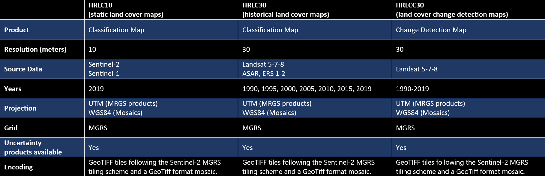
- HRLC10: High Resolution Land Cover Maps at 10m spatial resolution for year 2019 (sub-continental spatial extent, also referred to as static maps),
- HRLC30: High Resolution Land Cover Maps at 30m spatial resolution for years 1990, 1995, 2000, 2005, 2010, 2015, 2019 (regional spatial extent, also referred to as historical maps),
- HRLCC30: High Resolution Land Cover Change Maps at 30m spatial resolution of yearly changes. A map every 5 years (1990-1995, 1995-2000, 2000-2005, 2005-2010, 2010-2015,2015-2019) is provided which reports changed pixels and their year (high priority) within the 5-years temporal interval (regional spatial extent),
- Associated uncertainty products for each of the classification product lines HRLC10, HRLC30 and HRLCC30.
Products characteristics are as follows
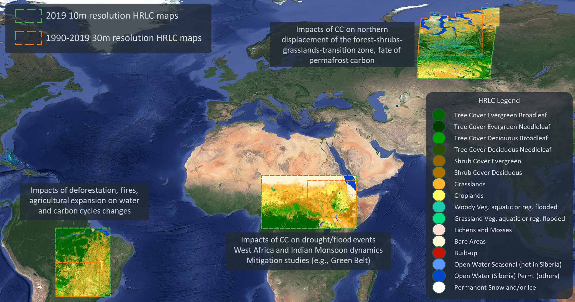
Products have been generated for three sub-continental areas within Africa, South-America and Siberia. Therefore they give a representation of very different ecosystems and climatic conditions.
DOWNLOAD:
This section provides access to the suite of data products.
CEDA Archive Project page
Sub-contnental/static land cover maps (HRLC10) CEDA Archive pages:
- Siberia (Northern Siberia region) at 10m spatial resolution for 2019
- Amazonia (Eastern Amazonas region) at 10m spatial resolution for 2019
- Africa (Eastern Sahel region) at 10m spatial resolution for 2019
Regional/historical land cover maps (HRLC30) and land cover change detection maps (HRLCC30) CEDA Archive pages:
- Siberia (Norther Siberia region) at 30m spatial resolution, 1990-2019
- Amazonia (Eastern Amazonas region) at 30m spatial resolution, 1990-2019
- Africa (Eastern Sahel region) at 30m spatial resolution, 1990-2019