
Data
The following products generated by High Resolution Land Cover ECV project are available with subcontinental or regional spatial extent:
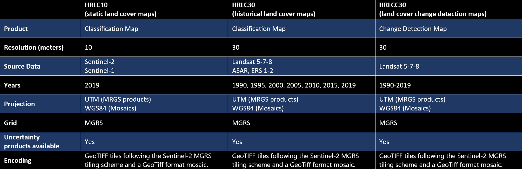
- HRLC10: High Resolution Land Cover Maps at 10m spatial resolution for year 2019 (sub-continental spatial extent, also referred to as static maps),
- HRLC30: High Resolution Land Cover Maps at 30m spatial resolution for years 1990, 1995, 2000, 2005, 2010, 2015, 2019 (regional spatial extent, also referred to as historical maps),
- HRLCC30: High Resolution Land Cover Change Maps at 30m spatial resolution of yearly changes. A map every 5 years (1990-1995, 1995-2000, 2000-2005, 2005-2010, 2010-2015,2015-2019) is provided which reports changed pixels and their year (high priority) within the 5-years temporal interval (regional spatial extent),
- Associated uncertainty products for each of the classification product lines HRLC10, HRLC30 and HRLCC30.
Products characteristics are as follows
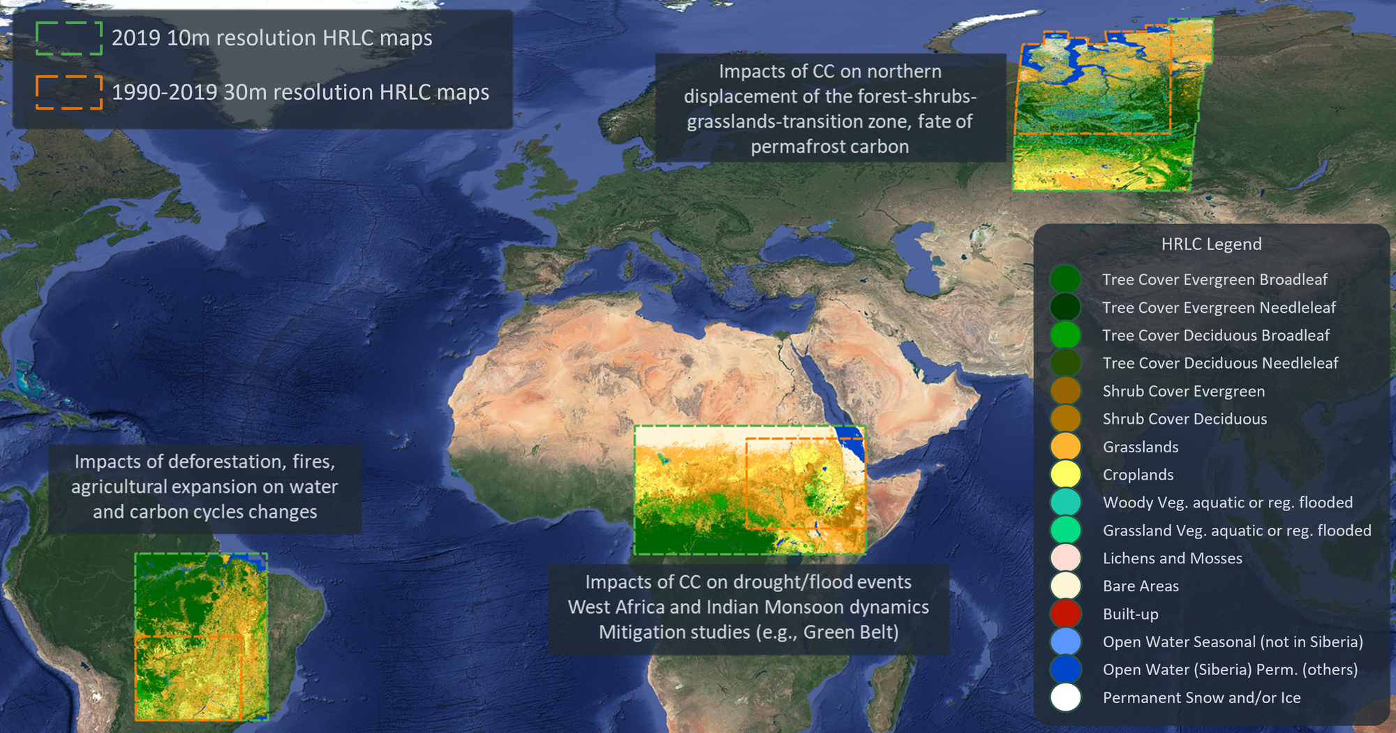
Products have been generated for three sub-continental areas within Africa, South-America and Siberia. Therefore they give a representation of very different ecosystems and climatic conditions.
DOWNLOAD:
This section provides access to the suite of data products.
CEDA Archive Project page
Sub-contnental/static land cover maps (HRLC10) CEDA Archive pages:
- Siberia (Northern Siberia region) at 10m spatial resolution for 2019
- Amazonia (Eastern Amazonas region) at 10m spatial resolution for 2019
- Africa (Eastern Sahel region) at 10m spatial resolution for 2019
Regional/historical land cover maps (HRLC30) and land cover change detection maps (HRLCC30) CEDA Archive pages:
- Siberia (Norther Siberia region) at 30m spatial resolution, 1990-2019
- Amazonia (Eastern Amazonas region) at 30m spatial resolution, 1990-2019
- Africa (Eastern Sahel region) at 30m spatial resolution, 1990-2019